Situated at the crossroads of temperate climates in the north and tropical climates in the south, Morocco is a veritable crossroads where cold and hot air masses meet, and their effects change with the seasons. Thanks to its unique geographical features, between mountainous relief and oceanic influences, the country reveals a mosaic of multifaceted climates. This article invites you to explore how these natural forces, combined with the variability of climatic factors, shape a Moroccan climate that is particularly sensitive to the fluctuations and effects of climate change. Read on to discover how Morocco’s geography transforms these influences to create an environment that is both fascinating and vulnerable.
Average temperatures in the coldest month of January are lowest on mountain peaks and in continental areas (Figure 2) [2,3]. The thermal buffer effect of the ocean is noticeable in coastal areas, which record milder values.
The annual rainfall distribution shows considerable spatial variability (Figure 5). The highest values are recorded on the peaks of the Rif (over 1200 mm/year), followed by the Middle Atlas (between 1200 and 1000 mm/year). Regions with favourable rainfall conditions (> 700 mm/year) cover only 7.1% of Morocco. The lowest values, below 100 mm/year, are found in the south-east and in the extreme desert south of the country. This distribution shows not only a north-south decrease in rainfall, but also a decreasing west-east gradient, which is explained by the Rif and Atlas Mountain barriers. It also highlights the low rainfall, not exceeding 200 mm/year, in the Haouz plain and the Moulouya basin. Sub-desert regions, which receive between 200 and 100 mm/year, cover 78% of the country. The rest of the country (17.9%) is covered by semi-arid and arid regions with rainfall between 200 and 600 mm.
On a smaller time scale (a few days), wet/dry sequences occur following the intrusion of cold polar air from higher altitudes. Westerly oceanic air, although infrequent, is considered the most favourable for the onset of rainy episodes, particularly in regions open to oceanic influences (Atlantic Morocco, Rif and Atlas Mountains). This underlines the key role played by the Atlantic Ocean in Morocco’s rainfall. Air from the north contributes to rainy days in the northern half of the country (e.g. Tangier, Ifrane and Oujda).
Mediterranean climate (Cs: temperate climate with dry summers, corresponding to the Mediterranean climate),
Arid steppe climate (BSh: steppe climate with hot, dry summers),
Arid desert climate (BWh: desert climate with hot, dry summers),
Mediterranean mountain climate (Ds: snowy climate with dry summers, found only on the high mountain peaks of the country).
Figure 6 shows the umbrothermal diagrams (according to the Gaussen-Bagnouls index [4]) for various stations representative of the different types of climates in Morocco.
This classification places Morocco in the global climate zones: temperate in the north (type C) and arid in the south (type B). However, considering the specific biogeographical features of the eastern part of the country, the term arid desert (type BW) corresponds to arid bioclimates with temperate to cool winters, according to the Emberger classification (see Focus The Emberger classification). Along the Mediterranean coast, from Kebdana to El Hoceima, the bioclimate is semi-arid with temperate winters. The Saharan bioclimate and its desert equivalent, according to Köppen, only appear from Figuig and Bouârfa stations onwards.
4.1. Mediterranean climate (Cs)
The Mediterranean climate zone is located on the western side of the continents between 30° and 40° latitude. By definition, the Mediterranean climate (Cs) is characterised by a dry season. It lies between the temperate climate in the north and the dry subtropical desert climate in the south. Another characteristic is the relatively strong increase in solar radiation towards the south.
Moving southwards, the Mediterranean climate (Cs) degrades towards semi-arid and arid bioclimates (or steppe-BSh) and hyperarid bioclimates (or desert-BWh). These qualifiers of steppe and desert, retained in the Köppen classification, evoke the desert degradation of Mediterranean climates with winter rain (Cs), which is difficult to define its southern limit because of the layout of the Atlas Mountains [5].
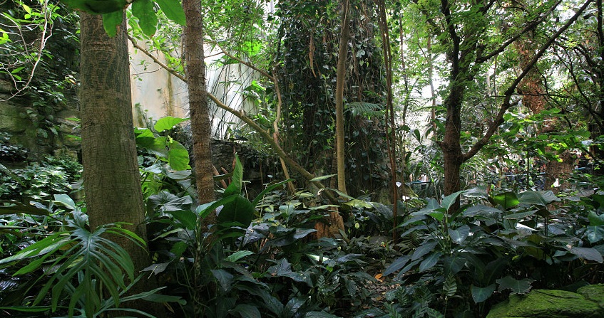
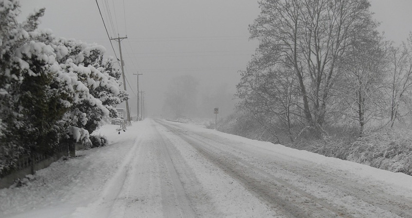
Even if the monthly minimum of minimum temperatures can reach critical values of -5.3°C in February in Ifrane (the record value is -24°C in February 1935), it makes no sense to exclude the mountainous climate of the Mediterranean climatic domain. It is the Atlas Mountains that have the most typically Mediterranean characteristics, because they are marked by a summer drought and because they are the only ones where we find the entire bioclimatic range of the Emberger climagram, from the hyperarid to the perhumid, with all the altitudinal thermal variants, from hot to extremely cold. This climatic diversity gives the Moroccan mountains a richness in terms of plant formations and a remarkable biodiversity on the scale of the Mediterranean climatic domain.
Risks of thunderstorms during the hot season can occur suddenly in mountain regions. This is the example of the torrential rains of 1995 and 1999 in the Ourika valley (Marrakech) which were responsible for deadly floods. Summer rains in mountainous regions can be accompanied by hailstorms that have a detrimental impact on rosaceae. The hailstorm of more than 5 mm, which occurred on June 6, 2020, in the Fez-Meknes region, was strongly perceived by the population, especially since it affected not only the mountainous regions of the Middle Atlas, but also neighboring cities such as Fez, Meknes and Taza.
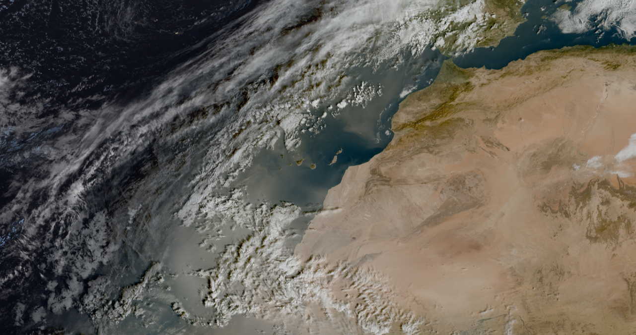
The Canary Reef Current is one of the four main eastern boundary currents of the oceans that are affected by the phenomenon of coastal upwelling [9], which corresponds to the upwelling of deep cold water on the continental shelf compensating for the drift of surface waters out to sea, under the combined actions of a favourable trade wind and the rotation of the Earth. The Moroccan Atlantic coast is exclusively crossed by this current, which is accompanied by upwelling of cold water, which varies over time. The surface waters, carriedby the trade winds, are replaced by deep cold water which makes the Canary Current even colder. This cold current trigger a thermal inversion at the base of the atmosphere that is observed from the city of Casablanca, thus promoting the condensation of the lower atmospheric layers in contact with the sea [10,11]. A cool, moist sea breeze blows towards the mainland, sucked in by the updrafts over the warming continent. But this inversion blocks the lifts, prevents rainfall and promotes fog that occurs quite frequently in the Casablanca hinterland.
Morocco’s geographical position, between tropical latitudes in the south and temperate latitudes in the north, makes it dependent on atmospheric conditions both at altitude and at the surface.
Local geographical conditions, such as the orographic effect, continentality, the western basin of the Mediterranean Sea, the cold Canary Current and the upwelling of cold deep waters off the Moroccan Atlantic coasts (or Upwellings), play a decisive role in modulating Morocco’s climate.
The northern half of the country has a Mediterranean climate, which gradually gives way to an arid desert climate to the south and an arid steppe climate to the east. The Rif and Atlas Mountain ranges give the country unique Mediterranean climatic conditions, where all bioclimatic variants can be found. The Moroccan mountains, the country’s water tower, play an essential role in the formation of solid precipitation, such as snow, which feeds both the water tables and the flow of surface water. Rainfall on the Atlas Peaks ensures the sustainability of water resources and crops in the oases, generating a unique microclimate that promotes their prosperity.
Under the influence of the trade winds, the cold ocean current of the Canary Islands exerts a marked influence on the climate of the Moroccan Saharan coast, bringing cooler temperatures and moderating the intense heat specific to the southern desert region. Accompanied by the upwelling of cold water, this phenomenon mitigates the impact of the desert heat, creating a more temperate climate along the coast. In addition, this mass of cold water promotes the formation of sea fogs and generates specific microclimates, which play a key role in increasing humidity and maintaining vegetation in coastal areas, especially south of Sidi Ifni.
In the face of climate variability and the potential effects of climate change, the entire country is increasingly threatened by longer and more recurrent drought crises that are accentuated by rising day and night temperatures and longer and longer heat waves. These effects, felt over the past decade, are now reflected in a nationwide water security crisis. Thus, drastic water management and saving measures have become a national priority for adaptation and resilience to climate change, because without sustainable management of this vital resource, our future will inevitably be compromised.
[2] CHELSA data (Climatologies at High resolution for the Earth’s Land Surface Areas) is a set of global climate data at very high resolution (30 arc seconds, ~ 1 km) hosted by the Swiss Federal Institute for Forest, Snow and Landscape Research (WSL).
[6] Delannoy, H. and Lecompte, M. (1980). Use of correspondence factor analysis for the study of daily precipitation: an example in Morocco. Méditerranée, Third Series, Volume 40, pp. 29-36. https://www.persee.fr/doc/medit_0025-8296_1980_num_40_4_1952.
[7] Due to a lack of means of observation, these climatic aspects of a reduced spatial scale have not yet been elucidated by research in Moroccan climatology.
[8] Train survey that we conducted in June 2023 as part of a national project funded by the CNRST (National Center for Scientific and Technical Research).
[9] Eastern Boundary Upwelling Ecosystems (EBUEs) are among the most productive ecosystems in the world. They cover a small ocean area (<1%) but contribute to 20% of the world’s fish catch.
The Encyclopedia of the Environment by the Association des Encyclopédies de l'Environnement et de l'Énergie (www.a3e.fr), contractually linked to the University of Grenoble Alpes and Grenoble INP, and sponsored by the French Academy of Sciences.
The articles in the Encyclopedia of the Environment are made available under the terms of the Creative Commons BY-NC-SA license, which authorizes reproduction subject to: citing the source, not making commercial use of them, sharing identical initial conditions, reproducing at each reuse or distribution the mention of this Creative Commons BY-NC-SA license.
The meteorology of tropical regions, marked by trade winds and their effects, is particularly capricious.…
René MOREAU, Professor emeritus at Grenoble-INP, Laboratoire SIMaP (Science et Ingénierie des Matériaux et des Procédés), member of the Académie des sciences and the Académie des technologies
Hidden under the waves, masked by the tides, a powerful circuit travels across the oceans…
René MOREAU, Professor emeritus at Grenoble-INP, Laboratoire SIMaP (Science et Ingénierie des Matériaux et des Procédés), member of the Académie des sciences and the Académie des technologies