


A brief history of hydrometry
PDF1. The Antiquity
In China, the first systematic water level surveys were reported to have begun in 251 BC on an irrigation complex. In 1078, Fan Ziyuan presented the principles of measuring a river flow in order to compare the water resources available on several rivers. The first surface speed measurements are taken on the Yellow River, using a horse running on the bank at the same speed as the surface current, which was followed by floats drifting along the river.
2. The Middle Ages and the Enlightenment
The Arab-Muslim civilization, however, had practically completed the theoretical reflection on the water cycle and & the origin of rivers around the 10-12th centuries (which Antiquity had not realized) and expressed the flow of a river as the number of mills that it could supply.
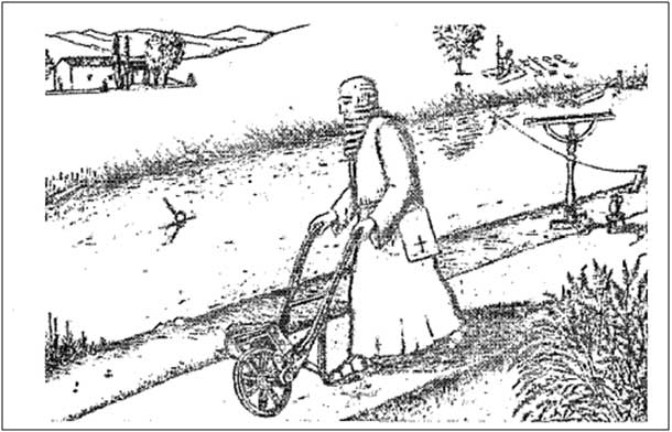
In the West, Leonardo da Vinci is studying the distribution of velocities in rivers and will conduct the first serious attempt to determine the velocity of the current by floats (Figure 1).
The 17th century saw the reflection continue, motivated by the analysis of the water cycle in nature. Pierre Perrault (1674) and Edmée Mariotte (1686) carried out the first precipitation/flow calculations on the Seine basin and carried out the first gauges (surface speed measurements with weighted sticks). Edmond Halley (1686) assesses the flows of the main rivers of the Mediterranean, compared to the Thames at Kingston Bridge. Domenico Guglielmini holds the first chair of hydrometry, created in Bologna in 1694.
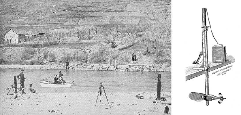
The 18th century saw the first systematic surveys of scales, in order to note and date at different points the level of flood rise: Seine in Paris (1719), Elbe in Magdeburg (1727), Rhine in Emmerich (1770)… The formalization of the laws of hydraulics (Antoine Chézy, Daniel Bernoulli, etc.) accompanied metrology; the devices for measuring river speed were improved: taking up the work of the English Robert Hooke and Henry de Saumarez on devices for measuring ship speed, Estavao Cabral (1786) and Reinhardt Woltman (1790) developed the first hydrometric reel. A little earlier (1732) the French Henri Pitot invented the Pitot tube, “a machine to measure the speed of running water and the wake of ships”. It is with this device in particular that gauging will be carried out on the Seine in Paris during the great flood of 1910; and that the speed of aircraft is still routinely measured today….
3. The modern era
In 1831, Henry Palmer designed the first continuous water level recorder (with recording on a paper graph); his invention was installed in 1832 on the Thames at Sheerness.
The complete sequence measures heights + gauges + calibration curve + continuous flow calculation is being implemented on a few rare sites: Rhine in Basel (1808), Memel in Schmalleninken (1812).
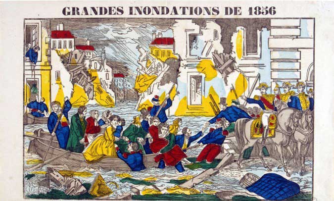
During this 19th century, as the socio-economic system became more complex and modern, it also became more vulnerable. The great floods of the 1840s and 1870s triggered major discussions in Western Europe. In 1854, Eugène Belgrand set up a monitoring system with the ambition of predicting the floods of the Seine in Paris three days in advance.
But the real densification of measurement networks, with the production of daily flow sequences, will only take place at the turn of the century, for the knowledge of hydroelectric potential: Norway (1890), Iceland (1894), Sweden (1907), France (1903). In 1906, 290 hydrometric stations were operating in Switzerland.
Proposed by the French Théophile Schloesing in 1863, dilution gauging – well adapted to mountain torrents – only became truly controlled in the early 1950s. The first tracers used called for very significant quantities to be spilled: for a river flow of about 2.5 m3/s, two gauges on the Guil on 17 February and 11 March 1944 called for the injection of 1480 and 2190 kg of denatured salt respectively. For this reason, other tracers were sought, stable, highly soluble and not present in water in its natural state. Sodium dichromate was introduced in France in the early 1950s and was massively replaced in 1990 by fluorescent rhodamine tracers.
Maurice Pardé (1893-1973) is the author of a monumental thesis on the Rhône (1925), an analysis that is still authoritative. He is considered to be the founder of potamology, the study of rivers and their regimes. Maintaining a network of correspondents from all over the world, it promotes hydrometric information in brilliant syntheses on the main rivers, particularly in the field of flooding.
From the 1960s onwards, other problems emerged (agricultural, drinking water, leisure, regulatory), measurement networks were no longer concentrated on landforms and “went down to the plains“: the stations were better distributed geographically.
Remote transmission of height data became widespread in the 1980s. In France, data from the Ministry of the Environment’s networks were made available to the general public by computer servers in the mid-1990s.
Between 1980 and 2010, the emergence of new techniques (ultra-sound velocity measurement, ADCP, LSPIV) finally made it possible to better understand the compartments poorly covered by hydrometry: flatland rivers at slow flow velocity, tidal reaches, torrents subject to flash flooding – with strong movement of associated sediments..
Further reading
LIU Guowei, Hydrology in ancient time in China, Proceedings of the International Symposium OH2 Origins and History of Hydrology, Dijon, 9-11 May 2001.
Danielle BONNEAU, Le nilomètre, technical aspects, Travaux de la Maison de l’Orient, volume 11, 1986.
Steponas KOLUPAILA, Bibliography of Hydrometry, University of Notre Dame, Indiana, 1961.
Collective work, Three Centuries of Scientific Hydrology 1674-1974, Background Reports presented on the occasion of the celebration of the Tercentenary of Scientific Hydrology, Paris, 9-12 September 1974, UNESCO-WMO/WMO-IAHS/AISH, ISBN 92-3-00 11924.
Denis CŒUR, Les inondations de mai-juin 1856 en France: de l’événement hydrométéorologique au nouvel engagement de l’Etat. Colloquium on regional extreme floods in Europe, historical perspectives. La Houille Blanche N°5/ 2004.
Jean de BEAUREGARD, Maurice Pardé potamologist (1893-1973). La Houille Blanche N°5-6/ 1994.