Understanding and preventing wildfires

PDF
Encyclopédie environnement - feux de végétation - wildfires

Improving policies to prevent and reduce fire risk in the natural environment and in peri-urban areas requires a thorough understanding of the factors that will contribute to the ignition of a first outbreak and then to its spread in the form of a flame front. The dynamics of a fire and its impact on a given environment depend on various parameters, such as the structure of the fuel layer (grass, shrubs, trees), the stress factors to which vegetation is subjected (water content, relative humidity and ambient air temperature, wind, slope of the ground), the exact nature of the impacted area (savannah, scrubland, forest, peri-urban area). We already know that the maximum power reached by some fires far exceeds the limits of the effectiveness of the most powerful means of control (helicopters, water bombers). It is for this reason that fire-fighting services around the world have for many years implemented a strategy based on the early attack of emerging fires. The effectiveness of this approach now seems to be reaching its limits, it is even starting to produce negative effects. Indeed, the first consequence of systematically eliminating low-intensity fires is to encourage the accumulation of biomass on the ground and thus aggravate an important risk factor.

1. Forest fires in a few figures

According to a study published in 2010 [1], satellite data combined with field observations provide a global estimate of the importance of wildfires worldwide by assessing the extent of ,burned areas. Over the period 1997-2008, it is estimated that an average of 371 million ha of natural areas (savannahs, grasslands, scrubland, forests, etc.) were burned each year (5.5 times the surface area of metropolitan France), of which 69% (256 Million ha) are located in Africa, 14.5% (54 Million ha) in Australia, 5.8% (22 Million ha) in South America (mainly in Amazonia), 4% (15 Million ha) in Central Asia, the rest (24 Million ha) mainly concerns the northern forests of North America and Asia. In comparison, Europe (mainly the Iberian Peninsula, Italy, Greece, southern France) is impacted by an average of 0.7 million ha per year.

Fortunately, a large proportion of these fires concern savannah and grassland areas, which, after a long evolution, represent the most suitable ecosystems for fires. These fires allow the maintenance of an open space and the renewal of species, guaranteeing a satisfactory forage quality for large herbivores.

More important than the extent of the area burned is the impact of fires on ecosystems: for example, savannahs and grasslands can partially burn each year, while the same event in a tropical rainforest will have extremely negative effects on fauna and flora. As early as the 1930s, ecologists argued that wildfires were not only as devastating as the effects perceived by the general public [2]. This school of thought has contributed to the emergence of a new discipline called fire ecology [3], the main purpose of which is to study the resilience capacities of ecosystems in the face of fire disturbance. It is most certainly because it has forgotten the important role that fires, like other natural events such as floods and landslides, play in the functioning of ecosystems that contribute to the renewal of plant species, the maintenance of certain ecosystems and the maintenance of biodiversity, that wildfires have become a problem.

Fire has long been a formidable spatial planning tool used by mankind for almost 10,000 years, to maintain open spaces for hunting, to clear land and to develop grazing or cultivation areas. Subsequently, the various waves of European colonization in Africa, North America, South America and Australia have resulted, among other things, in a decline in these traditional practices [4]. These disruptions have had a significant impact on many ecosystems, changing land use and promoting biomass accumulation. All this resulted in a series of catastrophic fires in the late 19th and early 20th centuries, particularly in the United States in the Great Lakes region and in the West (Peshtigo fire in 1871 in Wisconsin: 486,000 ha and 2500 deaths, BigBlowup in 1910 on the border between Idaho and Montana: 1 million ha and 87 deaths) [5]. In response to these fires, the American authorities have implemented a policy of systematic exclusion of forest fires, combined with a strategy of massive early attack on any detected fire source. This policy, which is widespread throughout the world, began initially with positive effects, reducing, for example, the area burned in the United States from 16-20 million ha in 1930 to 2 million ha in 1970.

Then, with the acceleration of rural exodus, the expansion of peri-urban areas and the first signs of climate change contributing to increasing the vulnerability of ecosystems (repeated droughts, invasion of wood-eating insects), this policy has reached its limits in terms of effectiveness, particularly in forest/habitat interface areas. More than the extent of the burned areas, it is the number of houses or structures destroyed by these fires (not counting the deaths) that must be taken into account when drawing up a balance sheet. In California alone, the number of houses destroyed in these circumstances has doubled in half the time period, from 3533 between 1955 and 1985 to 7467 between 1985 and 2000.

One of the major contributions of the ecological approach to wildland fire has been the introduction of the concept of a fire regime, which in particular makes it possible to define a natural frequency of fire that can be sustained by an ecosystem without irreversible effects in the long term. This parameter, based on dendrochronological data (analysis of wood rings and marks or charcoal left by the passage of a fire), is expressed in years on a scale from 0 to 500 years and over. Some tree species, such as the Giant Redwoods of California, can go back in time to more than 3000 years ago. The deviation from this reference data makes it possible to assess whether the situation is within the sustainable range or whether it threatens the local ecosystem.

2. Some elements of fire physics

Encyclopedie environnement - feux de vegetation - triangle feu - fire triangle wildfire
Figure 1. Fire triangle adapted to the case of wildfires. See ref.[6]
In a very schematic way, a vegetation fire can be assimilated to a flame front spreading through a vegetation canopy. The speed of movement of the front (often called propagation speed) varies according to three parameters: structure (litter, grassland, scrubland, forest, etc.) and the state (water content) in which the vegetation is located, the topography of the ground (flat, sloping, rising or falling relative to the path of the front), atmospheric conditions (wind, temperature, relative humidity of ambient air). These three factors (Fuel, Topography, Weather) (Figure 1) are to be compared with the three key elements (fuel, oxygen, heat) of the fire triangle used in fire safety to explain the elements required to develop a fire through a fuel load.

The impact of a fire front depends on the power it produces per unit length (fire intensity, expressed in kW/m); if the propagation rate is constant (established regime) it is calculated as the following product: combustion heat (kJ/kg)] x[fuel load (kg/m2)] x[propagation rate (m/s)]. This intensity varies according to the nature of the fire, ranging from a few hundred kW/m for a litter fire to almost 100,000 kW/m for the most intense forest fires (15 m from such a front releases a power of 1500 MW or the equivalent of a nuclear power plant unit! For example, the catastrophic fires that occurred in February 2009 in the Melbourne area of Australia (Black Saturday) were measured with an intensity of around 80,000 kW/m ; with propagation rates ranging from 1 to 3 m/s, the smoke plume reached 15 km high (lower limit of the stratosphere).

From a physical point of view, a fire is a combustion phenomenon that results from the decomposition of a solid fuel under the action of a heat flux from an external source at the time of ignition or from the flame front itself in the propagation phase. Subjected to this intense heat flow, the vegetation will first dry out, then degrade into gaseous products (mainly a mixture of carbon monoxide, carbon dioxide and methane) and solid products (charcoal). This will result in two combustion phases: homogeneous in the gas phase between carbon monoxide, methane and oxygen in the air, heterogeneous between charcoal and oxygen.

Two heat transfer mechanisms between the flames and the vegetation downstream of the flame front govern the spread of the fire: the radiation of hot gases [7] and especially soot particles present in the flame, heat exchanges by convection, i.e. by contact with hot gases which in certain circumstances can be pushed towards the vegetation still intact. The relative importance between these two modes of heat transfer depends mainly on the ratio between the two forces governing the flame and plume trajectory [8]: inertial forces due to wind action that tend to push the flame and hot gases in the direction parallel to the ground, Archimedes’ thrust due to the difference in density between the flame zone, the plume and ambient air, which tends to discharge hot gases vertically. The extent of Archimedes’ thrust obviously depends on the power of the plume, which in turn depends on the amount of fuel (biomass) on fire. The wind force alone does not explain the behaviour of a fire, what matters is the ratio between the two forces, gravity (plume) and inertia (wind), which can be assessed through a dimensionless number: the convective Byram number [9] which represents the power ratio between these two forces:

feux-vegetation_equation1

where g denotes gravity (9.81 m/s2), I denotes fire intensity (W/m), ρ (kg/m3) density, Cp (J/kg/K) specific heat, T0 (K) ambient air temperature, UW wind speed (m/s) and ROS (m/s) fire spread rate.

Two characteristic situations are at the origin of two modes of propagation of vegetation fires identified in the literature: (I) “wind driven fire” literally a fire pushed by the wind and (II) “feather dominated fire” a fire dominated by the effects of plume. In each of them, the consequences in terms of interaction between the flame front and the immediate environment are different. In case (I) the gas flow is directed downstream from the front and contributes to the convection heating of the vegetation, while in case (II) the heater is powerful enough to draw in fresh air downstream of the front; in this case the flame/vegetation energy transfer is essentially ensured by radiation. The more or less predictable nature of the flame front behaviour is strongly correlated with the more or less linear nature of the physical mechanism dominating the fire’s progression. If convection is dominant (regime I), the fire propagation rate will tend towards a more or less linear dependence on wind speed. If radiation is dominant (regime II), the highly non-linear nature of the heat flux emitted by the flame (Stefan-Boltzmann’s laws in T4, see footnote 7) associated with the fact that the flame front generates its own flow, will result in a relative decoupling between the propagation speed and the wind speed, and make it much more difficult to predict the fire’s behaviour.

3. Vegetation fires and forest/habitat interface

The probability of a fire and the preventive measures to be taken against this risk depend on the location. In a natural environment, within a national park for example, if the situation is in accordance with the fire regime that characterizes the ecosystem and if the safety of people and property is not affected, one may be tempted to do nothing (this is the “let’s burn” policy, literally let’s burn, implemented in the United States and elsewhere in some national parks), considering that we are dealing with a natural disturbance, as part of the normal functioning of a living ecosystem (some landscapes require fire to maintain themselves and renew species). In the case of a forest/habitat interface, on the outskirts of cities, we are very far from a natural process and in this case the safety of people and property becomes the first concern and we must intervene. Knowing that the efficiency limit of air assets for direct attack of a fire is around 7000 kW/m and that at full power it is not uncommon to detect powers of around 10 000 kW/m, or even to approach 100 000 kW/m (as during the black Saturday in Australia), it is easy to understand that as long as the weather situation (high temperature, strong wind, drought) that favoured the outbreak and spread of fire has not improved, it will be difficult to fully control the fire.

Professionals in charge of forest fire prevention and control (firefighters, foresters) work on two axes: early fire attack (option 1) and biomass reduction (option 2). Option 1 consists of pre-positioning ground and airborne firefighting capabilities when weather conditions exceed a certain critical threshold, with the aim of massively attacking any fire that emerges before it has time to develop and reach its maximum power level. This is the strategy implemented in particular in the departments of the South of France. For example, it is estimated that the time required before the first intervention in the Bouches du Rhône department is a few minutes. This approach requires enormous resources and remains suitable for relatively small territories (completely unsuitable for the large areas of the American West, for example). In addition, by preventing any low intensity fires, this policy will contribute to the accumulation of biomass on the ground, which will eventually lead to an increase in risk (one of the factors in the fire triangle, fuel).

Biomass reduction (option 2) can be achieved mechanically (brushing) or by prescribed burning. In both cases, this preventive approach requires upstream educational work with owners and local authorities to convince them of the effectiveness of these measures (fire triangle), which can also have some disadvantages such as cost, smoke, or the fact that it is not self-evident that fire can be a tool for forest fire prevention.

Preliminary risk assessment is an essential element, it is most of the time based on an empirical model, the “Fire Weather Index” (FWI), initially developed by the Canadian forestry services [10]. This risk index is constructed from an assessment of different water content indices at different depths in the soil based on the following four data: relative humidity and air temperature in the early afternoon, precipitation level in the last 24 hours and average wind speed. In France, this system has been adapted to the specific characteristics of the vegetation found on our territory, to produce a Forest Weather Index (FWI) every day during the summer period. The range of variation of this index is of course correlated to the power of the fires encountered; for example, it varies on a scale from 0 to 30 in Canada (Fort McMurray fire, which burned more than 600,000 ha in the state of Alberta in May 2016, was classified > 30) (see Figure 2 and 3) while the same scale varies from 0 to 20 in France.

From the data already available, it can be estimated that the risk of forest fires will increase very significantly in the near future, under the combined action of two factors: the increase in urbanization on the outskirts of cities and the development of forest/habitat interface areas, the impact of global warming on ecosystem vulnerability (temperature, rainfall, drought, insect attacks, etc.). The various reports produced by the Intergovernmental Panel on Climate Change (IPCC) have shown that the effects will be very significant in regions already heavily impacted by wildfires (boreal regions, Mediterranean areas) [11]. Nevertheless, even in a country with a temperate climate such as France, it is estimated that the fraction of territory that could potentially be affected by wildfires could grow by 30% by 2040 [12]. The increase in the means of control alone will not make it possible to cope with this increase in the level of risk.

Encyclopedie environnement - feux de vegetation - carte FWI - FWI map - wildfires
Figure 2. FWI (Fire Weather Index) map prepared for May 3, 2016 period during which Fort McMurray fires developed in Alberta (Natural Resources Canada). [Source: http://cwfis.cfs.nrcan.gc.ca/accueil]
Acting sustainably on the fire risk requires the restoration of a situation closer to the fire regime characteristic of a given ecosystem and for this purpose the reintroduction of fire as a tool for regulating the shrub biomass accumulated at ground level, in the form of prescribed fires. As in fire safety in buildings, biomass reduction is the only element of the fire triangle (Figure 1) on which action can be taken to reduce the fire risk in a sustainable way. With regard to the safety of property and people, as with other natural risks (flooding, submergence), it will be difficult not to review the conditions that have led to the urbanisation of certain areas, avoiding, for example, situations of urban sprawl (habitats scattered throughout the natural environment), which considerably complicate the conditions under which firemen and foresters operate. In regions where the level of risk is particularly high, innovative architectures should also be devised to reduce the level of vulnerability of dwellings, particularly in the treatment of roofs and openings.

Encyclopedie environnement - feux de vegetation - evacuation Fort McMurray - mc murray wildfire
Figure 3. Evacuation of Fort McMurray (a city of 80,000 people in the state of Alberta, Canada) in May 2016. [Source: https://en.wikipedia.org/wiki/2016_Fort_McMurray_wildfire]
More than the heat flow from a flame front, homes are subjected to a real rain of burning particles (pieces of bark, foliage torn off by the thermal plume) that will accumulate at roofs, gutters and at the bottom of openings. Some architects, for example, have designed structures on piles that prevent the accumulation of flaming particles at the bottom of openings. An appropriate choice of building materials used to protect openings (prefer good quality wooden shutters to PVC shutters, for example) is also an important element of security. A dwelling whose security is enhanced could retain the function of a refuge in the event of a fire and would make it possible, under certain well-defined conditions, to avoid the evacuation of residents, who in some cases may be an additional source of risk.


References and notes

Cover photo. [Source : DivertiCimes]

[1] GIGLIO, L., RANDERSON J.T., van der WERF, G.R., KASIBHATLA, P.S., COLLATZ, G.J., MORTON, D.C., DEFRIES, R.S. (2010). Assessing variability and long-term trends in burned area by merging multiple satellite fire products, 7, 1171-1186.

[2] CHAPMAN, H.H. (1932). Is the longleaf type a climax ?Ecology, 13, 4, 328-334.

[3] WHELAN, R.J. (1995). The ecology of fire. Cambridge studies in ecology. Cambridge University Press.

[4] STEWART, O.C. (2002). Forgotten fires, natives americans and the transient wilderness. Ed. H.T. LEWIS and M.K. ANDERSON. University of Oklahoma Press.

[5] COHEN, J.D. (2008) The wildland-urban interface fire problem, a consequence of the fire exclusion paradigm. Forest History today, Fall 2008, 20-26.

[6] LARIS P. ,2013 Integrating land change science and savanna fire models in west Africa, Land, Vol.2(4), pp.609-636.

[7] GIOVANNINI A., BECHAT B (2012) Heat transfer, Cépaduès editions.

[8] of CHATELET E. (1756) Mathematical principles of natural philosophy translation from Latin into French of “Philosophiaenaturalisprincipiamathematica” (1687) I. Newton.

[9] BYRAM, G. (1959), in K. DAVIS (Ed.) Forest Fire Control and Use. McGraw-Hill, New York, 90-123.

[10] TURNER, J.A., LAWSON, B.D. (1978). Weather in the Canadian Forest Fire Danger Rating System. A user guide to national standards and practices. Victoria, British Columbia: Environment Canada, Pacific Forest Research Centre.

[11] LIU, Y., STANTURF J., GOODRICK S., (2010), Trends in global wildfire potential in a changing climate, Forest Ecology & Management, Vol.259, pp.685-697.

[12] Commissariat Général au Développement Durable, Le risque de feu de forêts en France, Etudes & documents, August 2011, Vol.45, 41p.


The Encyclopedia of the Environment by the Association des Encyclopédies de l'Environnement et de l'Énergie (www.a3e.fr), contractually linked to the University of Grenoble Alpes and Grenoble INP, and sponsored by the French Academy of Sciences.

To cite this article: MORVAN Dominique (February 7, 2019), Understanding and preventing wildfires, Encyclopedia of the Environment, Accessed July 27, 2024 [online ISSN 2555-0950] url : https://www.encyclopedie-environnement.org/en/air-en/understanding-and-preventing-wildfires/.

The articles in the Encyclopedia of the Environment are made available under the terms of the Creative Commons BY-NC-SA license, which authorizes reproduction subject to: citing the source, not making commercial use of them, sharing identical initial conditions, reproducing at each reuse or distribution the mention of this Creative Commons BY-NC-SA license.

了解和预防野火

PDF
Encyclopédie environnement - feux de végétation - wildfires

  要改进预防和降低自然环境和城郊地区火灾风险的政策,需要充分了解导致燃火且火势蔓延的因素。火灾的动态及其对特定环境的影响取决于多种因素,如燃料层的结构(草、灌木、树木),植被所受的压力因素(含水量、相对湿度和环境空气温度、风、地面坡度),受影响地区的土地类型(草原、灌木林地、森林、城郊地区)。我们知道,一些野火的火势远远超过现有控制手段(直升机、水轰炸机)的灭火能力。正是由于这个原因,世界各地的消防部门多年来一直在实施一项灭火于萌芽的消防策略。这种做法的有效性现在似乎已达到了极限,甚至开始产生消极的影响。事实上,系统地消除低强度火灾的一个后果就是增加了地表生物量的积累,从而成为加剧野火风险的一个重要因素。

1. 森林火灾简介

  2010年发表的一项研究[1]结合了卫星数据与实地观测,通过估算烧毁面积,对野火在全球范围造成的影响进行了评估。据估算,1997-2008年期间,大约每年平均有3.71亿公顷的自然区域(稀树草原、草地、灌木丛、森林等)被野火烧毁(相当于法国本土面积的5.5倍),其中69%(2.56亿公顷)位于非洲,14.5%(5400万公顷)位于澳大利亚,5.8%(2200万公顷)位于南美洲(主要是亚马逊地区),4%(1500万公顷)位于中亚,其余(2400万公顷)主要分布在北美洲和亚洲的北部森林。相比之下,欧洲(主要是伊比利亚半岛、意大利、希腊、法国南部)每年平均有70万公顷的区域受到野火影响。

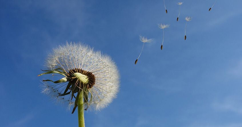
  幸运的是,这些火灾中的很大一部分发生在热带稀树草原和草原地区。经过长期演变,这些地区形成的生态系统已经适应了野火的发生。野火能够帮助该地区维持开阔空间,更新本地物种,并保证大型食草动物获得优良的食物来源。

  比烧毁面积更重要的是火灾对生态系统的影响。例如,热带稀树草原和草原每年都会有部分区域发生火灾,而同样的火灾如果发生在热带雨林则会对动植物产生严重危害。早在20世纪30年代,生态学家就认为,野火的破坏性并不像公众所认为的那样大[2]。这一学派的思想促成了一门新学科—火灾生态学的出现[3],其主要目的是研究生态系统受到火灾干扰后的恢复能力。野火之所以成为一个问题,是因为我们忽略了野火可以像其它自然事件(如洪水和滑坡)一样,在更新植物物种,保障生态系统运行和维持生物多样性方面中发挥着重要作用,

  近万年来,火一直是人类用来维持狩猎空地,开垦土地,开发放牧区或耕地的一种强大的空间规划工具。随后,欧洲在非洲、北美、南美和澳大利亚的殖民浪潮导致了这些传统做法的衰落[4]。这些破坏对许多生态系统产生了重大影响,改变了土地利用类型,促进了生物量的积累。这一切导致 19 世纪末 20 世纪初发生了一系列灾难性火灾,如发生在美国的五大湖区和西部地区的火灾(1871年威斯康星州的佩什蒂戈(Peshtigo)火灾:486,000公顷,2500人死亡,1910年爱达荷州和蒙大拿州边界的大火:100万公顷,87人死亡),[5]。为了应对这些火灾,美国政府实施了系统性的森林火灾排除政策,并采取对任何野火都尽早扑灭的策略。这项政策在全世界广泛推行,最初取得了积极的效果,例如,美国的火灾面积从1930年的1600-2000万公顷减少到1970年的200万公顷。

  随着农村人口加速外流,城郊地区不断扩大以及气候变化,生态系统变得愈加脆弱(反复干旱、食木昆虫的入侵),这项政策的有效性已经达到了极限,特别是在森林/居住地交界带。在制定资产负债表时,不仅要考虑被烧毁地区的范围,还要包括被火灾烧毁的房屋或建筑的数量(不包括死亡人数)。仅在加利福尼亚,在这样情况下被毁的房屋数量从1955年至1985年的3533间增加到1985年至2000年的7467间。在一半的时间内被毁的房屋数量翻了一番。

  生态学方法对野外火灾的主要贡献之一是引入了火灾机制的概念,可以让人们界定一个生态系统可以承受的自然火灾频率,而不会造成不可逆转的长期影响。这个参数基于树龄学数据(分析木材年轮和火灾遗迹或木炭),以年为单位,取值范围在0到500年或更长。一些树种,如加利福尼亚的巨型红杉,可以追溯到3000多年前。根据实际监测的参数与参考值进行对比,可以评估出可能发生的野火是否在生态系统可承受的范围内,或者是否会威胁到当地的生态系统。

2. 火的一些物理性质

环境百科全书-野火-火灾三角图
图1. 适应于野火案例的火灾三角形。见参考文献[6]

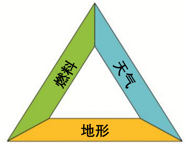
  简而言之,植被火灾可以被理解为在植被冠层中蔓延的火焰锋面。 火焰前锋的移动速度(通常称为传播速度)随三个参数的变化而变化:植被的结构(垃圾、草地、灌木丛、森林等)和植被状态(含水量),地表地形(平坦、倾斜、相对于火锋路径上升或下降),大气条件(风、温度、周围空气的相对湿度)。将这三个要素(燃料、地形、天气)(图1)与消防安全中的火灾三角形中的三个关键要素(燃料、氧气、热量)进行比较,以解释在可燃物上引发火灾所需的要素。

        火焰前锋的影响取决于其单位长度产生的功率(火势强度,单位为千瓦/米);当传播速率恒定时,火势强度可按以下乘积计算。[燃烧热(千焦/千克)]=[燃烧热(千焦/千克)]*[燃料负荷(千克/平方米)]*[传播速率(米/秒)]。燃烧强度根据火灾的性质而有明显的变化,从几百千瓦/米的垃圾火灾到接近104 千瓦/米的森林大火(距离火焰前锋15米处释放的功率为1500兆瓦,相当于一个核电站机组的功率)。例如,2009年2月发生在澳大利亚墨尔本地区的灾难性野火(黑色星期六),被测得的强度约为80000千瓦/米;传播速度为1至3米/秒,烟羽高达15公里(平流层底部)。

  从物理学角度看,火是固体燃料着火时在外界热源或火线传播过程中的自身热流作用下分解产生的燃烧现象。在这种强烈热流的作用下,植物首先会变干,然后降解为气体(主要是一氧化碳、二氧化碳和甲烷的混合物)和固体(木炭)。该过程可以划分为两个燃烧阶段:一氧化碳,甲烷和空气中的氧气之间的气相同质燃烧;木炭和氧气之间的异质燃烧。

  野火和火焰前锋下方的植被之间有两种热传导机制制约着火势的蔓延:高温气体[7],特别是火焰中的烟尘颗粒的辐射;对流热交换,即通过对流运动将高温气体推向尚未燃烧的植被层。这两种传热机制的相对重要性主要取决于控制野火和烟羽轨迹的两种力的比值[8]:风力作用产生的惯性力会推动火焰和热气沿平行于地面的方向移动;火焰区、烟羽和周围空气之间的密度差产生的阿基米德浮力会垂直排放热气体。浮力的大小主要取决于羽流的势能,而羽流的势能又取决于燃烧燃料(生物量)的数量。仅仅考虑风力本身这一因素并不能解释火灾的动态特征,重要的是重力(烟羽)和惯性力(风力)这两种力之间的比率,这可以通过一个无量纲数来评估: 对流拜拉姆数[9]代表这两种力量之间的功率比:

  其中g(9.81m/s2)表示重力,I(W/m)表示火灾强度,ρ(kg/m3)表示密度,Cp(J/kg/K)表示比热,T0(K)表示环境空气温度,UW表示风速(m/s),ROS(m/s)表示火灾蔓延率。

  文献中指出的植被火灾的两种传播模式源于两种特征情况:(I)“风驱动火”即由风推动火移动传播;(II)“烟羽主导火”即由烟羽影响火的传播。在这两种模式下,火焰前锋和周围环境相互作用的后果各不相同。第一种模式中,当气体从火焰前锋流向下方,会导致植被的热对流;而在第二种模式中,当火力足够强大,可以在锋面前方吸引新鲜空气,火焰与植被间的能量传输基本上是通过热辐射来实现的。火焰前锋行为的可预测性与主导火势发展的物理机制的线性性质密切相关。如果对流占主导地位(模式I),火焰传播速率将与风速呈线性关系;如果热辐射占主导地位(模式II),火焰释放的热通量的高度非线性性质(基于斯蒂芬玻尔兹曼定律,热辐射强度于温度的四次方成正比,参见脚注7)与火焰前锋产生自身流动的事实相关,导致传播速度与风速之间的关系脱钩,使得预测火灾行为变得更加困难。

3. 植被火灾和森林/居住地边界

  针对发生火灾的可能性,对于野火的预防措施取决于火灾发生的地点。自然环境中,以国家公园为例,如果野火在生态系统可承受的林火模态范围内,并且人员和财产的安全不受影响,人们可能不会对火灾进行干预。人们可能会考虑到所面对的是自然干扰,是生态系统正常运作的一部分(一些景观需要火来维持自身平衡和更新物种),因而什么也不做(这是在美国和其他一些国家公园实施的“燃烧”政策,意即任其燃烧)。如果火灾发生在城市郊区森林/居住地的交界处,而不完全是自然环境,在这种情况下,人员和财产的安全成为首要问题,所以必须进行干预。目前,空中直接灭火的极限功率约为7000kW/m,但是也会有火灾强度高达10000kW/m的情况出现,甚至会有罕见的火灾强度接近100000kW/m的情况(如澳大利亚的黑色星期六)。因此不难理解,只要出现有利于火灾爆发和蔓延的天气情况(高温、强风、干旱),火势将难以完全控制。

  负责森林火灾预防和控制的专业人员(消防员、护林员)从两个方面开展工作:尽早扑灭火灾(选项1)和减少生物量(选项2)。选项1包括在天气条件超过某个临界阈值时预先部署地面和空中灭火能力,目的是尽早扑灭还未来得及蔓延并达到其最大功率的野火。这是在法国南部某些地区实施的战略。例如,在罗讷河口地区扑灭早期野火的时间窗口是几分钟。这种方法需要大量资源,并且仅适用于相对较小的地区(在美国西部的大片地区就完全不适合)。此外,通过扑灭所有低强度火灾这项政策将有助于地面生物量的积累(火灾三角中的要素之一,燃料),这最终将导致区域野火发生风险增加。

  减少生物量(选项2)可以通过机械(剪枝)或规定焚烧来实现。这两种情况的预防方法都需要对所有者和地方当局进行普及教育工作,使他们了解这些措施(火灾三角形)的有效性。它也存在一些缺点:成本高、产生烟雾而且以火防火的策略并不是所有人都认可。

        初步风险评估是一个基本要素,大多基于经验模型,即最初由加拿大林业部门开发的 “火灾气象指数”(FWI)[10]。该风险指数是通过评估土壤不同深度的不同含水量指数构建的,基于以下四个数据:午后气温和相对湿度、最近24小时降水量和平均风速。在法国,该系统根据国境内植被的特征进行了调整,在夏季期间每天生成一个森林天气指数(FWI)。该指数的变化范围与所遇到的火灾的威力有关。例如,加拿大的指数从0到30不等(2016年5月在阿尔伯塔州烧毁了超过60万公顷的麦克默里堡大火的指数大于30)(见图2和3)。而在法国,指数则从0到20不等。

  根据现有的数据显示,城市化进程加快导致森林/居住地边界不断演变,加之全球变暖加剧了生态系统的脆弱性(温度、降雨、干旱、虫害等)。在这些因素的共同作用下,森林火灾的风险在不久的将来将显著增加。政府间气候变化专门委员会(IPCC)的各种报告显示,在已经受到森林大火严重影响的地区(北方地区、地中海地区),这种影响将非常显著[11]。而且,即使在气候温和的国家,如法国,据估计到2040年,可能受野火影响的地区将增长30%[12]。因此,仅靠加强控制手段无法应对升级的野火风险。

环境百科全书-野火-火灾天气指数(FWI)图
图2. 为2016年5月3日阿尔伯塔省麦克默里堡火灾期间绘制的火灾天气指数(FWI)图(加拿大自然资源部)。[来源:http://cwfis.cfs.nrcan.gc.ca/accueil]

  为了可持续地应对火灾风险,需要恢复符合特定生态系统特征的火灾机制,重新引入火作为工具,采用规定火灾的形式调节地面灌木的生物量。与建筑消防安全一样,减少生物量是火灾三角形(图1)中唯一可持续降低火灾风险的因素。关于财产和人身安全,与其他自然风险(洪涝、淹没)一样,必须要对一些区域城市化的条件进行审查,避免城市任意扩张的情况(住宅地分布在自然环境中)。这会使得消防员和护林员的工作条件变得愈加复杂。在风险程度特别高的地区,还应设计新型建筑以增强住宅的坚固性,尤其是在房顶和门窗的设计方面。

环境百科全书-野火-疏散麦克默里堡
图3. 2016年5月疏散麦克默里堡(加拿大艾伯塔州的一座拥有80000人口的城市)。
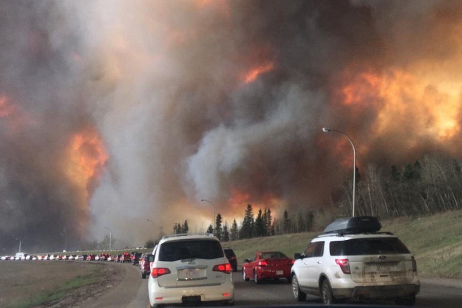
[来源:https://en.wikipedia.org/wiki/2016_Fort_McMurray_wildfire]

  比起火焰前锋热流带来的损害,房屋遭受到的更大的威胁来自正在燃烧的颗粒雨(被热流刮掉的树皮碎片、树叶),这些颗粒会积聚在屋顶、排水沟和门窗底部。一些建筑师设计了桩基建筑,以防止燃烧的颗粒在门窗底部聚集。选择可保护门窗的建筑材料(例如,选择优质的木质百叶窗而不是聚氯乙烯(PVC)百叶窗)也是增加安全性的重要手段。安全性能得到加强的住宅在发生火灾时可以提供避难的功能,避免疏散居民。在有些情况下,居民疏散的过程可能会是另一个危险源。


参考文献及注释

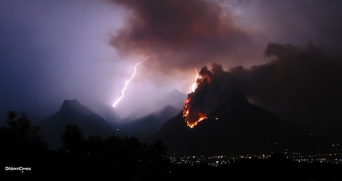
封面图片: (来源:DivertiCimes)

[1] GIGLIO, L., RANDERSON J.T., van der WERF, G.R., KASIBHATLA, P.S., COLLATZ, G.J., MORTON, D.C., DEFRIES, R.S. (2010). Assessing variability and long-term trends in burned area by merging multiple satellite fire products, 7, 1171-1186.

[2] CHAPMAN, H.H. (1932). Is the longleaf type a climax ?Ecology, 13, 4, 328-334.

[3] WHELAN, R.J. (1995). The ecology of fire. Cambridge studies in ecology. Cambridge University Press.

[4] STEWART, O.C. (2002). Forgotten fires, natives americans and the transient wilderness. Ed. H.T. LEWIS and M.K. ANDERSON. University of Oklahoma Press.

[5] COHEN, J.D. (2008) The wildland-urban interface fire problem, a consequence of the fire exclusion paradigm. Forest History today, Fall 2008, 20-26.

[6] LARIS P. ,2013 Integrating land change science and savanna fire models in west Africa, Land, Vol.2(4), pp.609-636.

[7] GIOVANNINI A., BECHAT B (2012) Heat transfer, Cépaduès editions.

[8] of CHATELET E. (1756) Mathematical principles of natural philosophy translation from Latin into French of “Philosophiaenaturalisprincipiamathematica” (1687) I. Newton.

[9] BYRAM, G. (1959), in K. DAVIS (Ed.) Forest Fire Control and Use. McGraw-Hill, New York, 90-123.

[10] TURNER, J.A., LAWSON, B.D. (1978). Weather in the Canadian Forest Fire Danger Rating System. A user guide to national standards and practices. Victoria, British Columbia: Environment Canada, Pacific Forest Research Centre.

[11] LIU, Y., STANTURF J., GOODRICK S., (2010), Trends in global wildfire potential in a changing climate, Forest Ecology & Management, Vol.259, pp.685-697.

[12] Commissariat Général au Développement Durable, Le risque de feu de forêts en France, Etudes & documents, August 2011, Vol.45, 41p.


The Encyclopedia of the Environment by the Association des Encyclopédies de l'Environnement et de l'Énergie (www.a3e.fr), contractually linked to the University of Grenoble Alpes and Grenoble INP, and sponsored by the French Academy of Sciences.

To cite this article: MORVAN Dominique (March 13, 2024), 了解和预防野火, Encyclopedia of the Environment, Accessed July 27, 2024 [online ISSN 2555-0950] url : https://www.encyclopedie-environnement.org/zh/air-zh/understanding-and-preventing-wildfires/.

The articles in the Encyclopedia of the Environment are made available under the terms of the Creative Commons BY-NC-SA license, which authorizes reproduction subject to: citing the source, not making commercial use of them, sharing identical initial conditions, reproducing at each reuse or distribution the mention of this Creative Commons BY-NC-SA license.