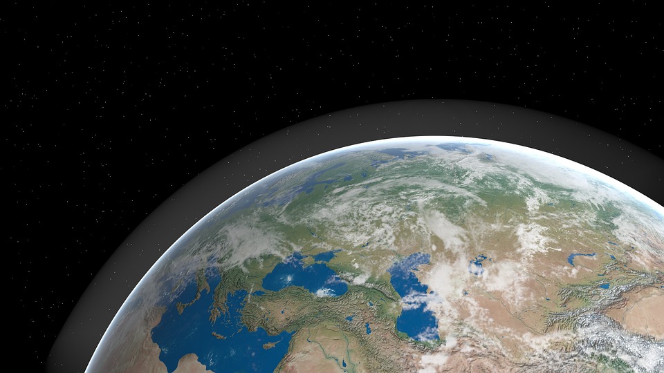
Atmospheric circulation: its organization

PDF
Encyclopédie environnement - circulation atmosphérique - couverture

The only driver of atmospheric circulation is sunlight. Under the constraints of gravity, Archimedes’ thrust and Coriolis’ force due to the Earth’s rotation, temperature differences between the equator and the poles cause air to circulate all around the Earth. This global circulation, driven by trade winds in tropical regions, has a well-defined organisation in each hemisphere: three convective cells in the meridian planes are associated with five winds along parallels, the weak eastern equatorial current in the vicinity of the equator and at low altitude, and in each hemisphere two westerly winds, the polar jet stream at a latitude near ±60° and at high altitude, as well as the subtropical jet stream, slower than the first, located at latitudes near ±30° and, also at high altitude. In their motion, these air masses transport and redistribute both the heat transmitted by the continents and the moisture produced by evaporation over the oceans.

1. First loop: Hadley’s cell

In the overheated equatorial region, which sees the Sun at its zenith, the air is lighter. Like smoke from a chimney, it rises upwards from the troposphere (see The Atmosphere and the Earth’s Gas Envelope) and draws in the air around it, creating winds that converge towards the equator. Since the Earth rotates, they are affected by the Coriolis force. Air from the north is diverted to the right, air from the south is diverted to the left. The convergence of these trade winds near the ground or the sea generates the equatorial easterly current, a steady wind, relatively slow since its speed is around 20 km/h, but which was sufficient to push Christopher Columbus’ schooners from Spain towards the West Indies and Venezuela. More details on this inter-tropical convergence zone can be found in the article The key role of the trade winds.

Encyclopedie environnement - circulation atmospherique - mecanisme vents alizes - trade winds - atmospheric circulation
Figure 1. Illustration of the motor mechanism of trade winds, their convergence towards the equator during the equinoxes, and the upward movement resulting from the lightening of overheated air, from L’air et l’eau, 2013. [Source : © EDP sciences]
The updraft of the trade winds charges into moisture as it passes over the oceans. As it crosses the troposphere it cools and dries out by condensation at high altitudes, and it gradually loses its momentum in its fight against gravity. It does not manage to exceed the altitude of the tropopause, very stable, which tops the troposphere like a kind of cover. However, at this altitude of about 15 km, its mass flow rate must be maintained. This is only possible if its trajectory curves in the form of horizontal winds, either to the north or to the south, depending on the hemisphere, forming two convective cells. George Hadley [1] (1685-1768), an English lawyer and amateur meteorologist in the 1730s, well before Gustave-Gaspard Coriolis’ work [2] (1792-1843), believed that these high-altitude currents were directed along the meridians and reached the polar regions where, cooled and heavy, they could dive towards the ground. This is not the case since, long before they reach the poles, the Coriolis force has the effect of twisting their trajectories, systematically eastward, in both the northern and southern hemispheres. This pseudo-force (see The key role of the trade winds) therefore prevents them from remaining in the meridian planes and imposes a helical atmospheric circulation within this Hadley cell illustrated in Figure 2. The influence of the Earth’s rotation thus limits the extent of this Hadley cell to latitudes close to ± 30°.

2. Further north: polar cells and Ferrel cells

Encyclopedie environnement - circulation atmospherique - circulation en helice - atmospheric circulation - helix velocity
Figure 2. Helix velocity of Hadley’s cell currents in its position during the equinoxes. The equatorial current, slow and stable, is represented by straight arrows. The faster and more unstable west current or jet stream is represented by wavy arrows. Based on L’air et l’eau, 2013. [Source : © EDP sciences]
Over the polar regions a convective circulation similar to that of the Hadley cell is imposed by the fall of cold, dry and heavy air, which arrives from the top of the troposphere, thinner at this latitude (about 7 to 8 km) than at tropical latitudes (approximately 15 km). However, the Coriolis force is greatest near the poles, where the axis of the Earth’s rotation is directed vertically; consequently, its influence is much greater than on Hadley’s cell, located near the equator where the axis of rotation is on the contrary almost horizontal. This is why the convective circulation in the vicinity of the poles remains contained between them and the parallels at ± 60°. Thus, between the extreme latitudes of Hadley’s cell (±30°) and the polar cell (±60°), driven by their respective movements, appears the cell (Figure 2) discovered by the American meteorologist William Ferrel [3] (1817-1891), which now bears his name.

Encyclopedie environnement - circulation atmospherique - circulation atmospherique globale - atmospheric circulation
Figure 3. Synthetic representation of the global atmospheric circulation. BP: region in relative depression, HP: region in high pressure where the subtropical jet stream is installed. The curved pink arrows show the wind deflection due to the Coriolis force, to the right in the northern hemisphere, to the left in the southern hemisphere. The troposphere is not represented on a global scale, so as to show its thickness, almost twice as large towards the equator (12 to 15 km) as near the poles (7 to 8 km) under the effect of convection. According to L’air et l’eau, 2013. [Source : © EDP sciences]
In each hemisphere, two regions can be noted where the air dives to the ground after cooling and drying up at altitude. Near the poles, this dry air supply leads to the formation of Arctic and Antarctic deserts. Between the Hadley and Ferrel cells, it creates the desert belt between the tropics and temperate regions: deserts in the southern United States, Sahara and Gobi desert in the northern hemisphere, Australian desert and Andean highlands in the southern hemisphere. On the contrary, the ascending zones, located near the equator for one and between the polar cell and the Ferrel cell for the other, are subject to heavy rainfall. Indeed, in the humid air at sea level, which cools and relaxes as it rises towards high altitudes where temperature and pressure drop sharply, condensation forms drops heavy enough to bring rain. These are frequent and abundant, which explains both the lush vegetation around the equator and the fertility of the soils in temperate latitudes.

3. Jet streams

In each hemisphere, below the tropopause (at an altitude of about 8 to 10 km above mean sea level), on either side of Ferrel’s cells and at high altitude, westerly winds appear which circulate all around the planet oscillating around a medium latitude. A major fraction of the atmospheric circulation, these winds are often referred to as the jet streams (Figure 4). They were discovered by the Japanese meteorologist Oishi Wasaburo in 1920 and described in a report [4] written in Esperanto so that it would be accessible to a large number of readers.

Encyclopedie environnement - circulation atmospherique - jet streams - atmopsheric circulation
Figure 4. Typical jet stream pattern around the globe, moving from west to east, on either side of Ferrel’s cell (yellow colour). The polar stream stream (blue color) is the fastest (its speed can reach 300 km/h) and the most unstable of the two. It is avoided by transatlantic flights to the west, but is sought by flights to the east. The speed of the subtropical jet stream stream never exceeds 100km/h. [Source : © NOAA]
These west-to-east winds are generated by the Coriolis force in narrow areas marked by both a large temperature difference between the warm air to the south and the cold air to the north, and large pressure differences. The mechanism that creates them is explained in the more detailed article Jet streams. Unlike the slow equatorial current, the polar jet stream is very fast, (speed between 100 and 300 km/h), and very turbulent, while the tropical jet stream is still slow (50 to 100 km/h) and more stable. This difference in speed between them and in relation to the slow equatorial east wind comes from a subtle mechanism, linked to the Coriolis force, which was only understood at the end of the 19th century by William Ferrel. The high speed of the polar jet stream and the more moderate speed of the tropical jet stream result from the conservation of a mechanical quantity very specific to rotating media, the angular momentum (The laws of dynamics). This mechanical quantity is the product of the absolute wind speed, the sum of the Earth’s speed and the relative wind speed with respect to the Earth, by the distance to the Earth’s axis. In short, at this altitude where friction on the ground is negligible, a high wind speed is required at the highest latitudes to compensate for the shortest distance to the Earth’s axis of rotation.

This article presents only the average state of atmospheric circulation, emphasizing its remarkable organization. Due to the seasonal movements of the zenith, the alternation between the oceans, which are sources of intense evaporation, and the drier continents, but also to its own instabilities, this atmospheric circulation is also subject to strong fluctuations, the description of which is the subject of complementary articles: The key role of the trade winds and jet streams.

4. Messages to remember

  • The air in tropical regions, heated by solar radiation and thus lightened, rises to the top of the troposphere. In doing so, it sucks in the trade winds that converge from the north and south towards the equator, creating the equatorial easterly flow and an updraft that leads to the formation of the Hadley cell in the meridian planes.
  • The rotation of the Earth, modelled by the Coriolis force, limits the extent of the Hadley cell to latitudes around 30° to the north and south. In the highest part of the troposphere, the air is diverted eastward, which generates a relatively slow subtropical jet stream (less than 100 km/h) in each hemisphere.
  • Between the poles and the ± 60° parallels, temperature differences impose a circulation similar to that of the Hadley cell, which leads to the formation of polar cells where the winds near the ground are oriented from the pole towards the temperate regions.
  • Between each Hadley cell and the polar cell of the same hemisphere, the Ferrel cell appears by continuity where the dominant wind at ground level is oriented towards the nearest pole.
  • At the top of the troposphere, the transition between the Ferrel cell and the polar cell is much more influenced by the Coriolis force than that between the Hadley cell and the Ferrel cell. This gives rise to polar jet streams, which are also oriented eastward. These jet streams are fast (100 to 300 km/h) and their trajectories are quite unstable.

References and notes

[1] George Hadley, Concerning the cause of the general trade winds, Philosophical Transactions of the Royal Society, 1735, vol. 39, p. 58-62

[2] Gaspard Gustave Coriolis, Mathematical Theory of the Effects of Billiards, Carilian-Goeury, 1835

[3] William Ferrel, An essay on the winds and the currents of the oceans, Nashville Journal of Medicine and Surgery, No. 4, 1856

[4] Oishi Wasaburo, Raporto de la Aerologia Observatorio de Tateno, Aerological Observatory Report 1, Central Meteorological Observatory, Japan, 1926 (in Esperanto)


The Encyclopedia of the Environment by the Association des Encyclopédies de l'Environnement et de l'Énergie (www.a3e.fr), contractually linked to the University of Grenoble Alpes and Grenoble INP, and sponsored by the French Academy of Sciences.

To cite this article: MOREAU René (May 12, 2021), Atmospheric circulation: its organization, Encyclopedia of the Environment, Accessed July 27, 2024 [online ISSN 2555-0950] url : https://www.encyclopedie-environnement.org/en/air-en/atmospheric-circulation-organization/.

The articles in the Encyclopedia of the Environment are made available under the terms of the Creative Commons BY-NC-SA license, which authorizes reproduction subject to: citing the source, not making commercial use of them, sharing identical initial conditions, reproducing at each reuse or distribution the mention of this Creative Commons BY-NC-SA license.

大气环流

PDF
Encyclopédie environnement - circulation atmosphérique - couverture

PDF

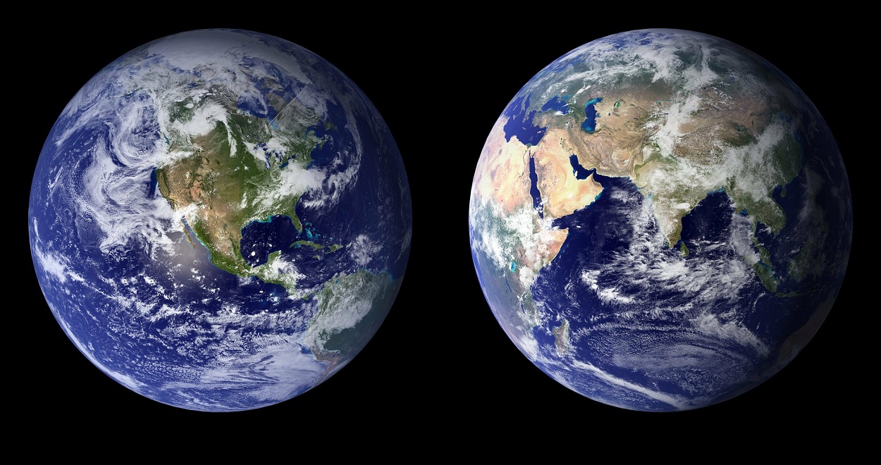
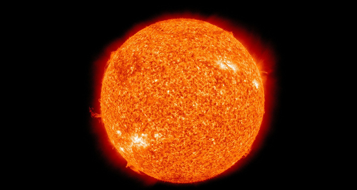
  大气环流的唯一驱动力是太阳辐射。在重力、阿基米德浮力和因地球自转的科里奥利力的作用下,赤道和两极之间的温差使大气环绕地球流动。这种由热带地区信风驱动的全球尺度的环流在南北半球都有明确的结构:三个经向环流与五个纬向风带相联系,包括赤道附近的低空弱东风带,在每个半球的两个西风带:南北纬60°附近的极地高空急流和南北纬30°附近的副热带高空急流(其速度慢于极地急流)。在大气运动过程中,这些气流输送并重新分配来自陆地的热量和来自海洋蒸发的水汽。

1. 哈德莱环流

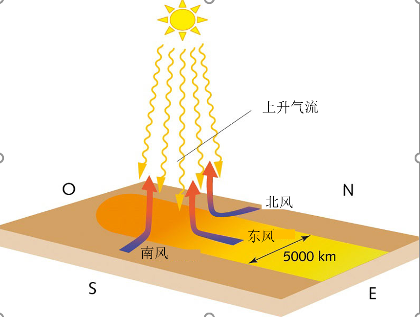
  赤道地区,在太阳直射的加热作用下,较轻的空气如同烟囱里的烟一样从对流层上升(见地球的大气层和气体层),周围的空气辐合,形成向赤道汇聚的风。受科里奥利力的影响,来自北方的空气转向右侧,来自南方的空气转向左侧。这些近地表的信风汇聚产生稳定缓慢的赤道东风气流,其速度虽然仅为20 km/h,但足以将哥伦布的帆船从西班牙推向西印度群岛和委内瑞拉。有关这一热带辐合带的更多详情,请参阅《信风的关键作用》一文。

环境百科全书-大气环流-信风的动力机制说明
图1. 北半球的东北信风和南半球的东南信风在赤道地区辐合,在近地面形成缓慢的东风气流,同时受赤道洋面加热作用变轻产生上升气流(来自L’air et l’eau, 2013)。[来源:©EDP科学公司]
  信风的上升气流在经过海洋时混入水汽。当它穿过对流层时,在高空冷却凝结变干,在重力作用下上升减缓,最终难以逾越像盖子一样稳定的对流层顶。当它上升支到达一定高度时,就分别转向南北(取决于在哪个半球)变成水平流动,以维持15km高空的气团通量守恒,从而形成哈德莱环流。乔治·哈德莱(George Hadley)[1](1685-1768)是17世纪30年代的一位英国律师和业余气象学家,他早在古斯塔夫·加斯帕德·科里奥利(Gustave Gaspard Coriolis)的著作[2](1792-1843)之前,就认为高空气流沿着子午线流向极地,在那里,气流冷却下沉。然而,事实并非如此,因为在气流远未到达极地之前,在科里奥利力的作用下,南北半球的气流都偏转向东,所以该虚拟力使哈德莱环流中增添了一段螺线状轨道的大气环流(见图2)。因此,由于地球自转哈德莱环流的范围限于南北纬30°。

2. 极地环流与费雷尔环流

环境百科全书-大气环流-哈德莱环流
图2. 哈德莱环流在春秋分的位置和速度。赤道东风缓慢而稳定,用直箭头表示。更快、更不稳定的西风带或急流用波浪箭头表示(来自L’air et l’eau, 2013)。 [来源:©EDP科学公司]

  在极地地区,与哈德莱环流相类似的经向环流是由来自对流层顶的冷干重空气的下沉造成的,这个纬度的对流层顶(约7到8公里)比热带对流层顶(约15公里)更低。然而,由于地球自转轴在极点附近是垂向的,在赤道附近几乎是水平向的,因此科里奥利力在极点附近最强,它施加到极地环流的影响比对哈德莱环流的影响大得多。这使得该对流环流的范围维持在南北纬60°。因此,在哈德莱环流(南北纬30°)和极地环流(南北纬60°)之间,出现了由美国气象学家威廉·费雷尔[3](1817-1891)发现并以他的名字命名的环流(图2)。

环境百科全书-大气环流-全球大气环流的整体展示
图3. 全球大气环流示意图。BP:低气压区,HP:副热带急流所在的高压区。弯曲的粉红色箭头表示由科里奥利力引起的风向偏转,北半球偏向风速右侧,南半球偏向风速左侧。图中未显示对流层的厚度,受强对流的影响,赤道(12至15公里)附近的对流层厚度几乎是两极(7至8公里)附近的两倍。引自L’air et al’eau, 2013。[来源:©EDP科学公司]

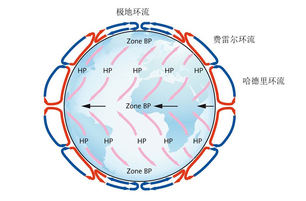
  在南北半球,都可以注意到一个区域,在那里空气在高空冷却和干燥后下沉至地面。在两极附近,这种干燥的空气供应导致了北极和南极干燥气候的形成。在哈德莱环流和费雷尔环流之间,它形成了热带和温带之间的沙漠,如美国南部的沙漠,北半球的撒哈拉和戈壁沙漠,南半球的澳大利亚沙漠,以及安第斯高山。相反,在赤道附近极地环流和费雷尔环流之间上升气流形成的雨带。事实上,在海洋上空,随着海拔升高,温度和气压急剧下降,空气中的水汽冷却凝结形成降雨。这些丰沛的降水为赤道周围茂盛植被和温带地区肥沃土壤提供了条件。

3. 急流

  在南北半球,对流层顶以下约8~10公里的高度、费雷尔环流两侧的高海拔处,存在绕地球中纬度循环并振荡的西风环流。作为大气环流的主要分支,它们是日本气象学家大石和三郎(Wasaburo Oishi)在1920年发现[4]的 ,通常被称为急流(图4)。

环境百科全书-大气环流-急流
图4. 全球典型的由西向东移动的急流模式,位于费雷尔环流的两侧(黄色)。极地急流(蓝色)最快(速度可达300 km/h),也是两者中最不稳定的。跨大西洋飞往西方的航班会避开它,但飞往东方的航班可以借助它。副热带急流的速度从未超过100公里/小时。[来源:©美国国家海洋和大气管理局]

  这些自西向东的风是由科里奥利力在狭窄区域产生的,这些狭窄区域的特征是南方的暖空气和北方的冷空气之间有很大的温差和气压差。它们的形成机制详见急流。与相对缓慢的赤道气流不同,极地急流非常快(速度在100到300公里/小时之间),扰动很强,相较之下,副热带急流仍然很慢(50到100公里/小时),并且更为稳定。

  它们之间的速度差异以及与赤道缓慢的东风有关的速度差异来自一种微妙的机制,这种机制与科里奥利力有关,直到19世纪末威廉·费雷尔(William Ferrel)才理解了这种机制。极地急流的高速和副热带急流的中速是由于旋转介质特有的力学量的守恒,即角动量动力学定律)守恒。该角动量是地球自转速度和相对地球自转的风速的矢量和,即风的绝对速度与地轴距离的函数。简言之,在这个高度,地面摩擦可以忽略不计,在最高纬度需要高风速来补偿到地球自转轴的最短距离。

  本文只介绍了大气环流的平均状态,旨在强调其一般规律。由于天顶角的季节性变化,海陆的干湿差异,以及大气环流自身的不稳定性,它会发生强烈波动,参见信风的关键作用急流

4. 要点

  • 热带地区的空气受到太阳辐射的加热而变轻,上升到对流层的顶部,南北方向的空气向赤道补充,形成了信风,从而形成哈德莱环流。
  • 由科里奥利力表征的地球自转影响将哈德莱环流的范围限制在南北纬30°左右。在对流层顶,空气转向东,在南北半球产生相对缓慢的副热带急流(小于100 km/h)。
  • 在极点和南北纬60°之间,温差产生了与哈德莱环流方向类似的极地环流,在这种环流中,靠近地面的风从两极吹向温带地区。
  • 在同一半球的哈德莱环流和极地环流之间,由费雷尔环流填充,为维持三圈环流的连续性,这一地区近地面盛行向极风。
  • 在对流层顶部,科里奥利力对费雷尔环流和极地环流之间转换的影响远大于对哈德莱环流和费雷尔环流之间转换的影响。这就产生了同样向东的极地急流。这些急流速度很快(100至300 km/h),并且其轨道相当不稳定。


参考资料及说明

[1] George Hadley, Concerning the cause of the general trade winds, Philosophical Transactions of the Royal Society, 1735, vol.39, p. 58-62

[2] Gaspard Gustave Coriolis, Mathematical Theory of the Effects of Billiards, Carilian-Goeury, 1835

[3] William Ferrel, An essay on the winds and the currents of the oceans, Nashville Journal of Medicine and Surgery, No. 4, 1856

[4] Oishi Wasaburo, Raporto de la Aerologia Observatorio de Tateno, Aerological Observatory Report 1, Central Meteorological Observatory, Japan, 1926 (in Esperanto)


The Encyclopedia of the Environment by the Association des Encyclopédies de l'Environnement et de l'Énergie (www.a3e.fr), contractually linked to the University of Grenoble Alpes and Grenoble INP, and sponsored by the French Academy of Sciences.

To cite this article: MOREAU René (September 28, 2023), 大气环流, Encyclopedia of the Environment, Accessed July 27, 2024 [online ISSN 2555-0950] url : https://www.encyclopedie-environnement.org/zh/air-zh/atmospheric-circulation-organization/.

The articles in the Encyclopedia of the Environment are made available under the terms of the Creative Commons BY-NC-SA license, which authorizes reproduction subject to: citing the source, not making commercial use of them, sharing identical initial conditions, reproducing at each reuse or distribution the mention of this Creative Commons BY-NC-SA license.