The key role of the trade winds
PDF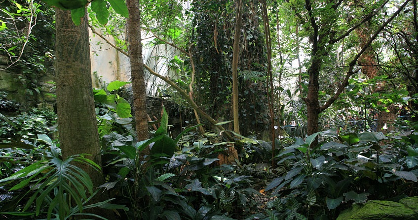
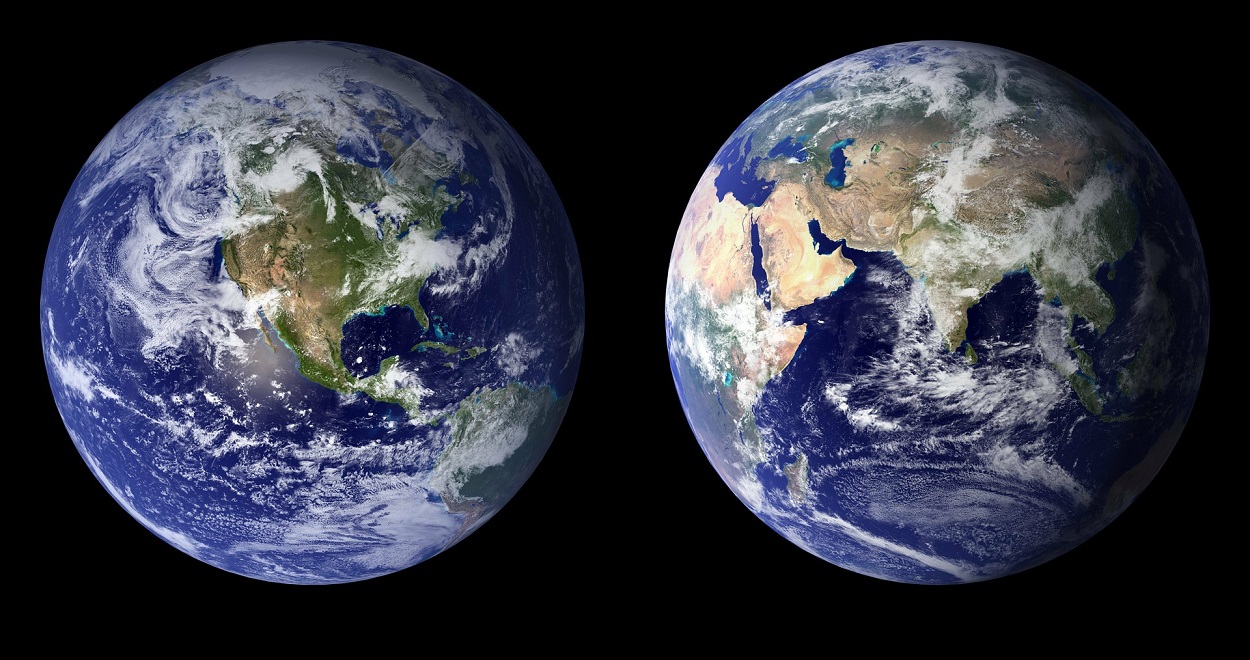
The meteorology of tropical regions, marked by trade winds and their effects, is particularly capricious. In the vicinity of the land or sea, the lightening of the overheated air in this region, which sees the Sun at its zenith, draws in trade winds from the north, east and south. These converge, rise in a strong updraft and generate the eastern equatorial current. At altitude, the upward movement diverges again, northward or southward, while bending eastward, before diving to the ground at latitudes of ±30°, forming Hadley’s cells. This convergence zone is subject to strong variations caused by the seasons, by the alternation between oceans and continents, as well as by the alternation between day and night. These disturbances lead to seasonal shifts from this convergence zone to the north and south, as well as a succession of warm and cold fronts that result in intense precipitation, often associated with severe storms.
1. The inter-tropical convergence zone
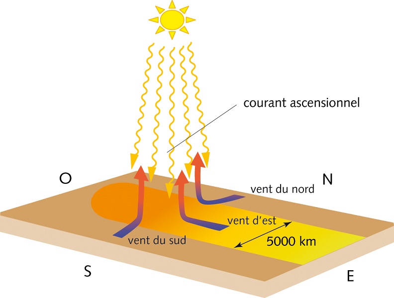

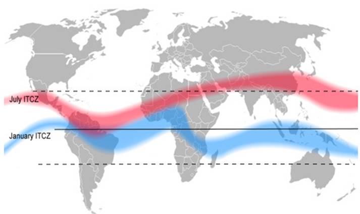
Controlled by the position of the Sun, the trade winds convergence zone shifts northwards during the summer, to the Tropic of Cancer located at a latitude of +23°26′. And during winter, this area undergoes the symmetrical movement towards the Tropic of Capricorn to the south (-23°26′). The Coriolis force, on the other hand, remains to the right in the northern hemisphere and to the left in the southern hemisphere. Since the convergence zone moves towards one of the tropics, the symmetry of the convergence zone with respect to the equator, present during the equinoxes, gradually weakens during spring and autumn and disappears during the solstices. As shown in Figure 2, the wind components along the parallels then become partially antagonistic. As a result, the velocity of the equatorial east current is much lower during solstices than during equinoxes.
The rise of trade winds is necessarily accompanied by heavy rains, caused by the condensation of water in the air that has become wet as it passes over the oceans. Moreover, this intertropical region is particularly well lit and heated by sunlight, so that photosynthesis (link to “Photosynthesis”) is very active there. This is why the intertropical region is covered with lush vegetation and thick forests.
2. The trade winds country, an area of great instability
The second mechanism that explains the temperature difference between oceans and continents is due to the good mixing of surface waters in the former. Their overall motion in the large thermohaline circulation, their periodic motions with the tides and the very random agitation due to swell and turbulence result in a tendency to homogenize their temperature by transporting much of the stored heat to areas further north or south. On the contrary, on the continents, only air can provide such convective heat transport (i.e. by transporting heat with this gaseous material). But its efficiency is considerably lower, because air is about 800 times lighter than seawater and its calorific capacity is 4 times lower. Everyone can check this property in their kitchen by trying to cool a dish that is too warm by watering it or blowing on it. On the other hand, winds are the effective agents for transporting water in the air, either as invisible vapour or in the form of mist and clouds. It is evaporation over the oceans that brings moisture into the air, to the point of saturation. This water load in the form of steam is no longer tolerable during a drop in pressure or cooling. Then condensation, i.e. a change from the vapour form to the liquid form, leads to the formation of fogs, clouds and, possibly, precipitation and storms.
3. Capricious weather of tropical regions
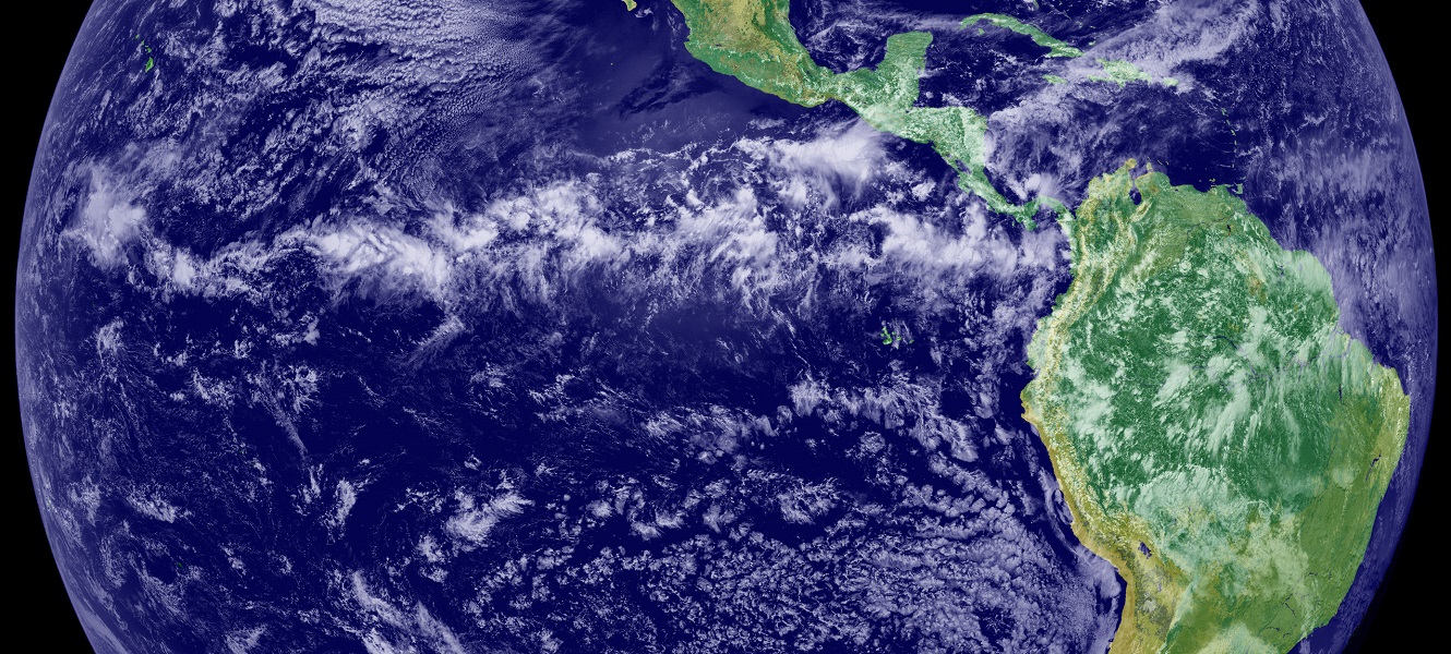
The formation of unstable and highly intermittent convective cells is one of the specific characteristics of the intertropical convergence zone [3], often referred to as ITCZ (Inter Tropical Convergence Zone). It is the result of a combination of several mechanisms. First, the presence of air heated from the ground, under colder and heavier masses brought by the trade winds, constitutes an unstable configuration. This results in a structured convection in cells with very variable horizontal dimensions and a maximum altitude that can reach the troposphere boundary. This organization leads to a succession of warm and cold fronts. Cold fronts are the boundaries of the coldest and heaviest air masses, which force warmer and lighter air masses to pass over them. This lifting is systematically accompanied by cooling and expansion. The result is a rapid condensation, which leads to the formation of very characteristic clouds, the cumulonimbus clouds recognizable by their anvil top, as well as sometimes very heavy rains, accompanied by violent storms such as the one that caused the tragic accident of the Rio-Paris flight on June1, 2009 (read Thunderstorms: electricity in the air).
In conclusion, the inter-tropical convergence zone (ITCZ) generated by the trade winds exhibits very specific characteristics. It can be considered as the main trigger for atmospheric circulation, first in Hadley’s cell and then throughout the troposphere (read Atmospheric circulation: its organization). It is marked by the violence of tropical storms (read Thunderstorms: electricity in the air) which gave rise to the French expression “pot-au-noir”, introduced by the 19th century sailing navy to designate this dangerous area. This expression is still used today by crews of transatlantic flights from one hemisphere to another, and by tall ships engaged in round-the-world races.
References and notes
[1] Gaspard Gustave Coriolis, Mathematical Theory of the Effects of Billiards, Carilian-Goeury, 1835
[2] https://fr.wikipedia.org/wiki/Albédo
[3] https://en.wikipedia.org/wiki/Intertropical_Convergence_Zone
The Encyclopedia of the Environment by the Association des Encyclopédies de l'Environnement et de l'Énergie (www.a3e.fr), contractually linked to the University of Grenoble Alpes and Grenoble INP, and sponsored by the French Academy of Sciences.
To cite this article: MOREAU René (January 5, 2025), The key role of the trade winds, Encyclopedia of the Environment, Accessed July 25, 2026 [online ISSN 2555-0950] url : https://www.encyclopedie-environnement.org/en/air-en/key-role-of-the-trade-winds-2/.
The articles in the Encyclopedia of the Environment are made available under the terms of the Creative Commons BY-NC-SA license, which authorizes reproduction subject to: citing the source, not making commercial use of them, sharing identical initial conditions, reproducing at each reuse or distribution the mention of this Creative Commons BY-NC-SA license.