Thunderstorms: electricity in the air

PDF
storms - thunderstorms - orages

Thunderstorms are made up of clouds called cumulonimbus. A combination of phenomena (updraft of moist and warm air, condensation, evaporation, downdrafts of cool air) causes intense precipitation, wind gusts, lightning and thunder, which can impress by their violence. Let us take a closer look at what governs these phenomena and their consequences.

1. What is a thunderstorm?

 Encyclopédie environnement - orages - cumulonimbus cellule convective
Figure 1. Photograph of a cumulonimbus showing the convective cell, with its ascending column in the centre and the anvil at the top. [© Sfortis, June 2009]
The simplest thunderstorm consists of a cell, called a convective cell, in which parcels of air rise (in the centre) and others subside (in the periphery). This results in the formation of a cloud called cumulonimbus, which extends vertically to the top of the troposphere around 10-15 km (see The Earth’s atmosphere and gaseous envelope) and exhibits a mushroom shape shown in Figure 1. The foot of the mushroom consists of the central column where the air rises, and the cap of the mushroom consists of the anvil, where the air spreads laterally at the tropopause level. A cumulonimbus made up of a single cell (Figure 1) has fairly moderate horizontal dimensions, with thesis of the anvil being typically ten kilometres. Cumulonimbus clouds can also be organized into multi-cellular clusters with several updrafts and downdrafts. In this case their horizontal dimensions can exceed 100 km, but the dynamics and evolution of each element of the ensemble remain governed by the same mechanisms.

 Encyclopédie environnement - orages - ligne de grains - line of grains - grain line
Figure 2. A line of grains. The anvil common to these various cores is very large: a) photograph of a grain line [© NOAA, June 2012], b) radar image of a grain line above Texas and Mexico [© NOAA, March 2012]. The colour scale in Figure 2b represents the radar reflectivity, which measures the intensity of rainfall, more intense in yellow and red.
This is the case, for example, of squall lines, formed by several aligned convective cores [1] (Figure 2). Other examples of convective organizations exist. For example, in cyclones (see Tropical Cyclones: development and organization), the energy comes from a warm ocean surface and the structure is controlled by the air circulation. In any case, all these systems are made visible by the condensation of water in their cloud masses.

2. How does a thunderstorm work?

In the lower layers of the atmosphere, the air is mixed. The air parcels move up and down with the turbulence. The pressure of air parcels that rise in the cumulonimbus gradually decreases as the ambient pressure becomes lower and lower (see article The atmosphere and the Earth’s gaseous envelope). Since they exchange little heat with their environment, their pressure decrease is adiabatic (link to article “Thermodynamics and entropy”), which leads to cooling. They can then reach conditions of temperature and pressure that cause water condensation. This change of state, however, requires the presence of germs (aerosols or micro droplets already formed), around which the water molecules initially dispersed among the nitrogen and oxygen molecules that are the main components of dry air come together. This is how the cloud is formed, usually within the first few hundred metres of upward motion. At higher altitudes, when the temperature falls below 0°C, condensation can occur directly as ice crystals. However, droplets may remain in a liquid state, in a supercooling state, up to temperatures of -40°C.

Condensation releases latent heat (unlike evaporation, which causes cooling). Thus, while the temperature drop in the troposphere (see The Earth’s atmosphere and gaseous envelope ) is on average about 6.5°C per kilometre, in the ascent of cumulonimbus it can be only 5°C per kilometre. This helps to make the rising air warmer and lighter than its environment. Under the influence of Archimedes’ force of buoyancy, this air continues to rise to the altitude where the cumulonimbus air parcels are as dense as their surroundings. This explains the large vertical extension of cumulonimbus clouds to altitudes of 10 or 15 km, i.e. to the upper limit of the troposphere. As they reach the stratosphere, the rising particles encounter higher temperatures, and therefore lighter air, which results in negative buoyancy and stops the vertical development of the cloud. Since upward motions continue below, the cloud spreads horizontally forming the anvil visible in Figure 1. The dark aspect of cumulonimbus [2] is that this thick cloud reflects and absorbs sunlight which diminishes the amount of solar radiation arriving at surface level (see The colors of the sky).

At the beginning of convective ascent, micro-droplets may rise or remain suspended as long as their fall speed is less than the updraft velocity of the air. On the other hand, the largest and heaviest drops, formed as a result of collisions and coalescences of smaller drops, fall and form rain. Similarly, the most developed ice crystals form snowflakes, which can return to a liquid state during their fall at altitudes where the temperature returns to above 0°C. Hail is formed by icing as a result of repeated collisions between ice particles and droplets of supercooled water. It is also remarkable that some hail circulates several times in the convective loop, up to the top of the troposphere where the temperature drops to less than -40°C, alternating phases of crystal agglomeration, freezing and icing, as well as partial remelting, which can lead to an internal structure in concentric layers similar to onion peels.

thunderstorm
Figure 3. Synthetic diagram of the functioning of a storm, with the representation of a gust capable of generating a new lift and propagating this storm to the left.

The drier ambient air of the middle troposphere, at altitudes between 4 and 8 km, interacts with the precipitation that is present on the periphery of this cloud mass. This leads to partial evaporation of the falling drops, which cools and weighs down the surrounding air, forming unsaturated descents [3], i.e. cold and heavy descending air currents (Figure 3). When they reach the ground, these currents spread horizontally, creating winds called density currents. These can generate strong and sudden gusts, which are warning signs of the storm. As shown in Figure 3, these cold and heavy air masses can in turn lift the potentially unstable air initially present in the lower level to form new ascents. This is how a thunderstorm spreads, causing new ascents downstream of the density currents. When the intensity and direction of the ambient wind varies sufficiently with altitude, the thunderstorm circulation can acquire a marked eddies characteristic, resulting in the production of tornadoes (see Tornadoes, powerful devastating eddies).

3. Conditions for thunderstorms

Once the functioning of the storm is understood, the conditions conducive to its development can be deduced. In the lower layers, processes that contribute to the lifting of air parcels, such as wind gusts in density currents, or sea breezes and mountains, are favourable to the initiation of thunderstorms.

Once an air parcel is lifted, the atmosphere must still be unstable enough to continue to rise. This instability is due to the fact that the rising air parcel is warmer and therefore less dense than its environment. In practice, the atmosphere is more unstable when the air near the ground surface is heated, particularly by sunlight. This is why, on the continents, sunny summer days are favourable to the development of storms. In addition, for rising air to form a cloud, it must contain sufficient moisture to release latent heat through condensation in liquid droplets and ice crystals.

4. Lightning and thunder

The best known of the light signatures of a storm is lightning. It results from the ionization of the air in a scenario that can be summarized as follows [4]. Collisions between different ice particles are accompanied by exchanges of electrical charges whose polarity depends on temperature. If it is cooler than -15°C, the smallest particle (an ice crystal) carries a positive charge while the largest (frosted aggregate or ice pellet) carries a negative charge. If the temperature is warmer than -15°C, the polarity is reversed: the small crystal carries a negative charge, then the large particle carries a positive charge. As small crystals are transported to altitude by updrafts while larger crystals fall to the surface, sedimentation of the charges gradually occurs. The resulting overall electrical structure is essentially bipolar, with a negative charge in the central part of the storm where the temperature is between -15 and -40°C, and a positive charge towards the top where the temperature is below -40°C. The structure can also be tripolar, with a secondary positive charge towards the cloud base where the temperature is above -15°C.

The progressive separation of electrical charges produces an electric field in the cloud of increasing intensity, up to values greater than 100 kilovolts per meter (100 kV/m). As the electric field hardly enters the water, it bypasses the hydrometeors present in the air (liquid water drops or ice particles) and strengthens in their vicinity, much like an obstacle on a traffic lane causes an accumulation of vehicles. When the intensity of the electric field thus exceeds a few hundred kV/m, the air becomes locally conductive and small sparks carrying electric charges spontaneously develop from the ends of the hydrometeorites. This is the Corona effect [5] or peak effect, which also manifests itself in the St. Elmo Fires, small electrical discharges that appear at the ends of ship masts or aircraft wings in stormy weather.

These small sparks are grouped into precursors, a few meters long, which develop in the cloud by jumps of a hundred meters, covered in a few microseconds. As they progress sporadically, they trace the characteristic shape of lightning with multiple branches. When precursors with opposite polarities charges meet, the resulting sudden neutralization produces a powerful electric current that flows through the ionized channel and brings it to temperatures above 10,000°C. The channel then shines with very bright light and also emits strong radiation in the radio wave band. This high warming causes air to expand faster than the speed of sound, resulting in a shock wave like the bang of an aircraft crossing the sound barrier. This energy then spreads like a sound wave, it’s thunder. Since the speed of sound at 340 m/s is about one million times slower than that of light, the time difference T between the visual observation of lightning and the hearing of thunder makes it possible to estimate the distance D to D (km) ≈ T (s) / 3.

Some sufficiently energetic precursors continue their jerky propagation out of the cloud, causing an increase in the electric field at their front end by peak effect. At the surface, the reinforced field can induce the same type of sparks and precursors that develop upward from various pointed structures (tree or building tops, mountain peaks, even umbrellas, golf clubs or ice axes, etc.). When the precursor from the cloud meets a precursor rising from the surface, the neutralization of the thunderstorm electrical charge towards the ground causes a cloud-to-ground lightning, such as those often visible at the tip of the Eiffel Tower or on crosses placed on high mountain peaks. The neutralization of electrical charges, inside the cloud or between the cloud and Earth, is rarely complete. Further neutralizations can be repeated up to ten times in a row within the ionized channel that has been formed. These are the return arcs whose total duration is less than a second, and which can be visually identified by the thrilling nature of many flashes.

A lightning bolt can be represented as a conductive channel from one hundred metres to ten kilometres long, a few centimetres wide. The difference in potential between its ends is a few tens of millions of volts, and the intensity of the electric current flowing through it exceeds a thousand amperes. The power released in a flash is on average 10 to 100 billion watts (Gigawatts – GW), more than that produced by a nuclear reactor. But the very short duration of the discharges (a few tenths of a second) and the very sporadic nature of the lightning flashes, both in space and time, make the dream of solving our energy problems by producing electricity from storms illusory.

 Encyclopédie environnement - orages - phénomènes lumineux transitoires - transient light phenomena
Figure 4. Illustration of transient light phenomena visible in the stratosphere and mesosphere during a storm event. From top to bottom, we can see elves, or halos in the shape of red rings, leprechauns or red sylphs hanging towards the Earth, an upward blue jet directed from the tropopause towards the stratosphere, and finally lightning in the troposphere, between the cloud and the ground. [Source : © NOAA]
Thunderstorms also generate lesser known, impressive but ephemeral light phenomena. They occur above the clouds and are therefore difficult to see from the ground. These transient light phenomena [6] [7] (Figure 4), which appear in the stratosphere and mesosphere, between 20 and 100 km above sea level, have only been studied for about 20 years, although older observations by aircraft pilots and astronauts mention them. Responding to the poetic names of elves, sylphs, sprites or blue jets, with beautiful red-orange, blue-green or indigo colours and disc, halo, jellyfish or beam shapes, they result from the ionization of the very tenuous upper atmosphere by positive discharges that emanate from the upper part of some powerful thunderstorms, and spread upward in an increasingly diffuse manner. The CNES Taranis [8] space mission, currently scheduled for launch in 2020, will aim to observe in detail, in several wavelengths, these light phenomena that are still imperfectly understood.

5. Storm Interactions with Atmospheric Conditions

In some regions, such as the Intertropical Convergence Zone (ICTZ) (see Atmospheric Circulation and The Key Role of Trade Winds), convective cumulonimbus clouds can occur over large horizontal areas (several hundred km). Outside the clouds, where the sky is clear, the air, like any body, emits infrared radiation (link to the article Thermal radiation). It thus loses energy, cools down and thus descends at speeds less than 1 cm/s. In contrast, upward motions up to 30 m/s are concentrated in the central part of the thunderstorms [9] (Figure 5).

Figure 5. Role of thunderstorms in tropical circulation. Large-scale lift areas consist of both clear sky areas, where air descends, and thunderstorms, where air rises vigorously. In storms, condensation releases latent heat that heats the air. This heating makes the air column less dense and induces large-scale convergence in the lower layers.

There is also an amplification effect between storms and large-scale atmospheric circulation called positive feedback [10]. Thunderstorms are favoured in areas of large-scale uplift, where moisture converges. In return, the release of the latent heat they induce helps to lighten the air column, thus reducing surface pressure and promoting large-scale air convergence (Figure 5). This amplification explains why convection is generally organized on a large scale, in the form of large clusters.

Thunderstorms also have a fundamental role in the transport of energy and water vapour in the atmosphere. They heat the air aloft by releasing latent heat, and cool it in the lower layers by partial evaporation of rain. They therefore have a stabilizing role on the temperature profile. In the anvil of the convective column, water vapour and some of the ice crystals in the rising air are expelled out of the cloud, moistening the upper troposphere and lower stratosphere. Humidity in the stratosphere plays an important role in the greenhouse effect and in the balance of the ozone layer.


Notes and references

Cover photo. [©Alain Herrault, Diverticimes (www.diverticimes.com)]

[1] Houze RA. (1977). Structure and dynamics of a tropical squall line system. My. Weather Rev. 105: 15401567.

[2] Craig F. Bohren (1997). Les nuages noirs, La Météorologie, 19: 49-51.

[3] Zipser, E. J. (1977). Mesoscale and convective-scale downdrafts as distinct components of squall-line structure. Monthly Weather Review, 105(12), 1568-1589.

[4] Roux, F. (1991). Thunderstorms. Editions Payot.

[5] https://wikipedia.org/wiki/Effet_corona

[6] Soula, S. and van der Velde, O. (2009) Transient light phenomena over storms: observation and production conditions. Meteorology, 64:20-31.

[7] Soula, S., Huet, P., van der Velde, O., Montanya, J., Barthe, B. and Bór, J. (2012). Of the jand giant ones above an isolated storm near Reunion Island. Meteorology, 77:30-40.

[8] https://taranis.cnes.fr/

[9] Emanuel, K. A., David Neelin, J., & Bretherton, C. S. (1994). On large-scale circulations in convecting atmospheres. Quarterly Journal of the Royal Meteorological Society, 120(519), 1111-1143

[10] Risi, C. and Duvel, J.-P. (2014). The omadden-Julian scillation, the main mode of intra-seasonal variability in the tropics. Meteorology, 86: 57-65.


The Encyclopedia of the Environment by the Association des Encyclopédies de l'Environnement et de l'Énergie (www.a3e.fr), contractually linked to the University of Grenoble Alpes and Grenoble INP, and sponsored by the French Academy of Sciences.

To cite this article: RISI Camille, ROUX Frank (July 16, 2019), Thunderstorms: electricity in the air, Encyclopedia of the Environment, Accessed July 27, 2024 [online ISSN 2555-0950] url : https://www.encyclopedie-environnement.org/en/air-en/thunderstorms-electricity-in-the-air/.

The articles in the Encyclopedia of the Environment are made available under the terms of the Creative Commons BY-NC-SA license, which authorizes reproduction subject to: citing the source, not making commercial use of them, sharing identical initial conditions, reproducing at each reuse or distribution the mention of this Creative Commons BY-NC-SA license.

雷暴:空中之电

PDF
storms - thunderstorms - orages

  雷暴诞生于积雨云之中,其形成常伴有暖湿空气上升、凝结、蒸发以及冷空气下沉等一系列过程,以及随之产生的强降水、阵风及电闪雷鸣,来势汹汹,震撼人心。本文将深入探究雷暴现象背后的支配力量,以及其带来的一系列后果。

1. 什么是雷暴?

环境百科全书-雷暴-云朵
图1.对流单体积雨云,其上升流位于云体中心,顶部为云砧。[来源:斯福蒂斯(Sfortis),2009年6月,版权所有]

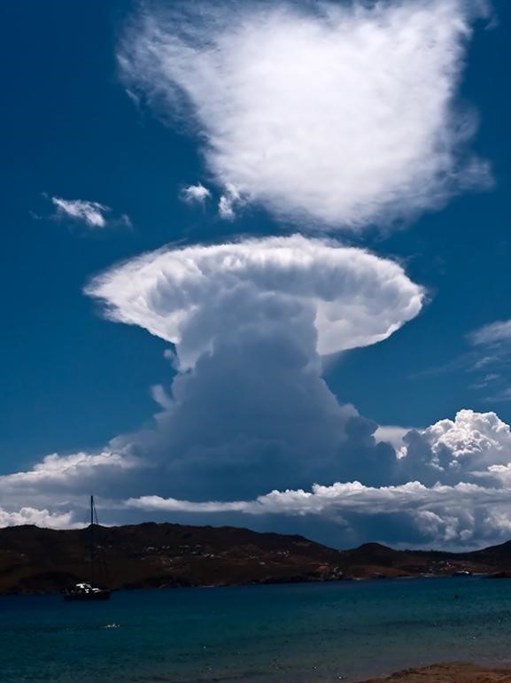
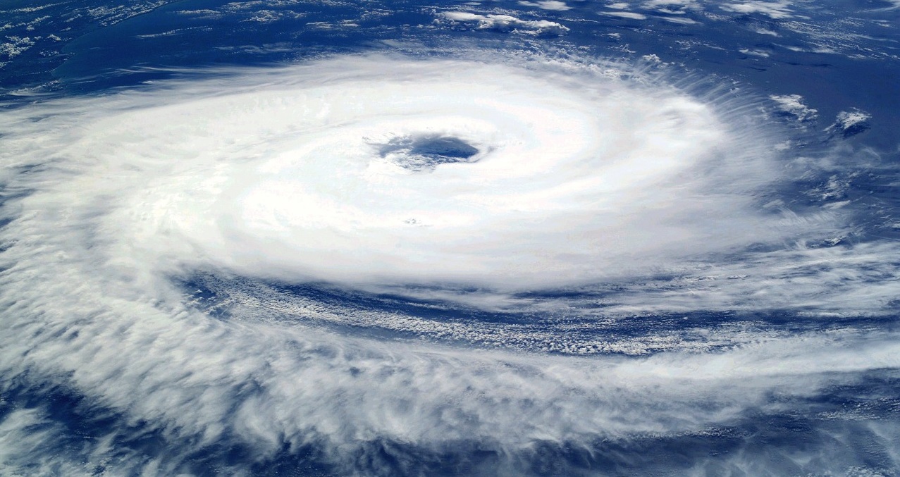
  一个对流单体(convective cell)便可构成最简单的雷暴结构,雷暴云体中心空气团上升,外沿空气团下沉,由此形成的云体即为积雨云(cumulonimbus)。积雨云向上延伸至对流层顶,垂直尺度可达10-15 km(详见《地球的大气层和气体层》),状似蘑菇(图1)。蘑菇状云体底部为上升气流,顶部由于空气在对流层顶水平向外辐散而形成云砧。由对流单体构成的积雨云(图1)水平尺度较小,据相关文献记载,其云砧的长度通常可达到10 km。积雨云有时由多单体构成,水平尺度可超过100 km,内含多组上升与下沉气流,但其中每个单体仍然遵循各自的动力机制及演化过程。

环境百科全书-雷暴-飓风
图2.飑线。多单体雷暴的云砧规模非常大,a)飑线的照片[来源:美国国家海洋和大气管理局(NOAA),2012年6月,版权所有],b)德克萨斯州和墨西哥上方的飑线的雷达图像[来源:©美国国家海洋和大气管理局(NOAA),2012年3月,版权所有]。图2b中的颜色表示雷达反射率,可表示降雨强度,黄色和红色代表降水更强。

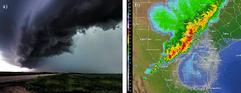
  图2所示系统为飑线(squall lines),由几个并列的对流单体[1]组成(图2)。除此之外,对流结构还可构成其它系统。如气旋(详见《热带气旋:发展和结构》)就是从温暖的海表中获取能量,形成气旋性环流结构。无论哪种对流结构,都会因为云团中的水汽凝结而变得清晰可见。

2. 雷暴如何运作?

  大气低层空气混合运动较为剧烈,空气团在湍流的作用下上下运动。在积雨云内部的上升运动过程中,随着环境大气压的不断降低(详见地球的大气层和气体层),气团气压也逐渐降低。由于气团鲜少与环境进行热量交换,所以其在绝热(adiabatic)(详见“热力学和熵”)状态下降压并逐渐冷却,达到水汽凝结所需的温压条件。除此之外,相态变化还需要凝结核(气溶胶或已经形成的小水滴)的参与。干燥大气的主要成分为氮气和氧气分子,水分子最初分散于这些分子之间,而后在凝结核的作用下,逐渐在其周围聚集,凝结成云。该过程常发生于上升运动伊始几百米范围内。在温度低于0℃的高空,水汽可直接凝华为冰晶,但液滴仍可能保持液态,称之为过冷状态(supercooling),该状态下的温度可低至-40℃。

  蒸发过程会吸热,导致环境冷却,凝结过程则与之相反,可以释放潜热。一般而言,当对流层平均垂直温度递减率约为每公里下降6.5℃(详见《地球的大气层和气体层》)时,在积雨云上升气流区,这一数值仅为每公里下降5℃,故上升气流比其周边环境更暖且更轻。根据阿基米德浮力定律,空气将持续上升至与周围环境空气密度一致的高度。正因如此,积雨云才可垂直上升至10至15公里的高空,直至对流层顶。平流层(stratosphere)具有更高的温度,因而空气质量更轻,所以当上升气流到达该处时,便会遭受负浮力作用,导致垂直发展受阻。与此同时,下部气流仍在持续上升,推动云顶水平扩散,形成如图1所示的云砧。厚实的云层反射并吸收了大量太阳光,从而减少了到达地球表面的太阳辐射量,因此积雨云下往往略显黑暗[2](详见《天空的颜色》)。

  对流伊始,小水滴下降速度不敌上升气流速度,将保持上升或悬浮状态。部分水滴则会在运动过程中碰撞合并其他小水滴,变大变重,从而下落形成降雨。较大的冰晶也会由相似的过程形成雪花,其在下落至温度0℃以上的高度时,便会变回液态。冰雹则是冰粒和过冷水滴之间反复碰撞冻结形成的。部分冰雹在对流环流中可历经多次循环,到达温度低于-40℃的对流层上层时冻结为冰,下落至低层后再部分融化为水,导致其内部结构状似洋葱皮。

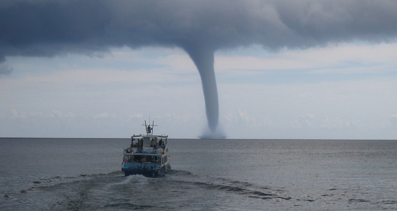
  在高度4到8公里的对流层中部,空气较为干燥,当雷暴云团外围的降水经过该环境时,二者之间将会发生相互作用。干燥的空气导致部分下降水滴蒸发吸热,冷却环境空气,并拖曳周围空气,形成冷而重的下降气流,即不饱和下降(unsaturated descent)[3](图3)。下降气流到达地面后随即发生水平运动,该现象被称为密度流(density current)。这些密度流可产生迅猛的阵风,作为风暴来临的预警信号。雷暴传播的方式如图3所示,冷而重的气团在水平运动过程中可抬升原本处于低层的潜在不稳定气团,触发新的上升运动趋势。当雷暴云周围风场强度及垂直风切变较大时,雷暴环流将表现出明显的涡旋特征,可催生龙卷风(详见《龙卷风:强大的毁灭性漩涡》)。

3. 雷暴的条件

  理解了雷暴的演变过程,便可推知有利于其发展的条件。在低层大气中,密度流中的阵风,海风以及山脉等皆可成为上升运动的触发机制,进而引发雷暴。

  只有上升气流温度较环境更高,密度较环境更低,使得大气垂直结构足够不稳定,空气团才能够在被迫抬升后持续上升。在实际大气环境中,近地表的空气受到加热作用,尤其是阳光加热作用时,往往会导致大气结构不稳定,这也是大陆上阳光明媚的夏天风暴频发的原因。此外,上升气流凝结成云的前提是其中包含充足的水分,能够在凝结为液滴和冰晶的过程中释放潜热。
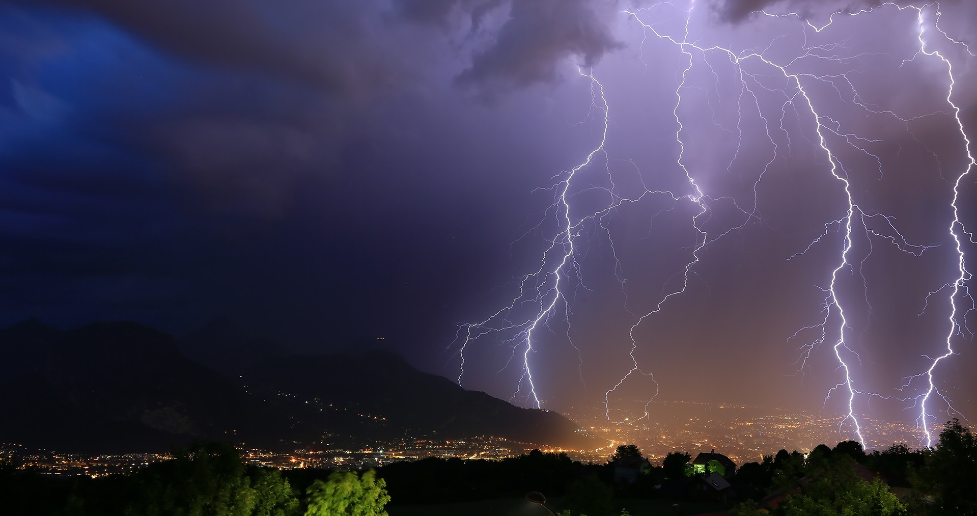
4. 闪电和雷

  作为雷暴最广为人知的光现象,闪电由空气电离产生,其机制可总结如下[4]:冰粒子之间的碰撞伴随着电荷交换,其极性取决于环境温度。温度低于-15℃的环境中,较小的粒子(冰晶)携带正电荷,较大的粒子(霰或冰球)携带负电荷;温度高于-15℃的环境中,极性则会逆转,小晶体携带负电荷,大粒子携带正电荷。随着小晶体被上升气流输送至高空,大晶体下落至低层,电荷逐渐沉降。因此雷暴云整体电荷结构本质上为双极,其中负极位于温度介于-15到-40℃之间的风暴中心,正极位于温度低于-40℃的雷暴云顶部。部分雷暴云在温度高于-15℃的云底另有一个次生正极,此时雷暴云整体电荷结构为三极。

  电荷逐步分离促使云中电场不断增强,最高电压可达到100 kV/m。电场具有排水性,因而会主动绕过空气中的水汽凝结体(液态水滴或冰粒),并其在附近加强,该过程可类比为车道上的障碍物导致堵车。当电压超过数百千伏每米时,空气便会产生局部导电性,从水汽凝结体的末端自发形成携带电荷的小火花,该现象被称为电晕效应(corona effect)[5]或峰值效应(peak effect)。许多例子都体现了电晕效应,如圣埃尔莫火(St. Elmo Fires),以及暴风雨天气中船只桅杆或机翼末端常见的小型放电现象。

  小火花聚集形成数个长约几米的前导闪接,仅几微秒的时间内便可在云层中跳跃数百米。由于这种聚集相对零散随机,闪电通常呈现出多分叉的形状。当携带相反电荷的前导彼此相遇时,电荷被迅速中和,随即产生强电流通过电离通道,带来高达10000℃的高温。电离通道因此发出炫目光线,以及强烈的无线电波辐射。急剧升温导致空气以高于声速的速度急速膨胀,产生类似于飞机穿过声障时的冲击波。这种冲击波如声波一般向外传播,就形成了我们常见的雷声。因为声速为340 m/s,比光速慢100万倍,所以可以根据目视闪电和听闻雷声之间的时间差T,估测闪电发生的距离D,具体公式如下:D(km)≈T(s)/3。

  能量较为充足的前导闪接可冲破云层,向外迅速传播,并通过峰值效应增强其前端电场。这种增强电场可作用于地表的各种尖端(如树木、建筑物顶端、山顶、甚至雨伞、高尔夫球杆或冰镐等),诱使其与前导闪接产生相同的电火花。随着地表产生的前导闪接向上发展,与来自云体的前导闪接相遇,雷暴与地面携带的电荷便彼此中和,激发云对地闪电,该类闪电常见于埃菲尔铁塔顶端或山顶十字架。但无论是云层内部,还是云层与地表之间,电荷皆难以一次性完全中和。因此,电离通道内还将继续发生类似的中和作用,次数可达十余次,总持续时间不到一秒,并产生肉眼可见的炫目返回弧。

  闪电可视为一种导电通道,长度范围从100米到10公里不等,宽约几厘米。其两端电位差约几千万伏特,电流强度可超过一千安培,瞬时功率平均为100亿至1000亿瓦(10-100 GW,gigawatt,千兆瓦),远大于核反应堆瞬时功率。但是,闪电持续时间较短,一般仅有十分之几秒,且在空间和时间上都极具偶然性,所以通过雷暴产生的电力来解决能源问题的梦想终究难以实现。

环境百科全书-雷暴-风暴结构
图3.风暴综合结构图,其中体现了能够催生新上升气流并推动雷暴向左传播的阵风。
Cumulonimbus 积雨云 condensation 凝结 propagation 传播 gusty winds阵风 re-evaporation 再蒸发

  除闪电外,雷暴可产生另一短暂的光现象。这一鲜为人知,却撼人心魄的现象发生于云层之上,因此从地面上难以窥得其貌。瞬态光现象(transient light phenomena)[6][7](图4)往往发生于大气平流层和中间层(mesosphere)之间,距离海平面20到100公里。尽管诸多飞行员和宇航员都曾提及这一现象,但其研究历史至今不过20年。瞬态光现象源于强雷暴顶部的正放电,使得高空稀薄大气发生电离,并逐渐向上辐散。其色彩常为美丽的红橙色、蓝绿色以及靛蓝色,形状似光盘、光晕、水母或光束,因此,人们也赋予了它们诸多充满诗意的名称,如精灵、空气精灵、调皮鬼或蓝色急流等等。目前,法国空间研究中心(CNES)于2020年计划发起的“塔拉尼斯”航天任务[8],旨在从多个波段对这一罕为人知的现象进行细致观察。

环境百科全书-雷暴-急流
图4.雷暴中,平流层和中间层上的瞬态光现象示意图。从上到下依次为具有红色光环的“精灵”、朝向地球倒悬着的“矮妖”(又称“红色小精灵”)、从对流层指向平流层的“蓝色急流”,以及对流层中云层与地面之间的闪电。[来源:美国国家海洋和大气管理局(NOAA),版权所有]
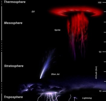
Elf精灵 sprite矮妖 blue jet蓝色急流 lightning闪电 thermosphere热层 mesosphere中间层 stratosphere平流层 troposphere对流层 altitude海拔高度

5. 风暴与大气的相互作用

  在赤道辐合带(ICTZ)(详见《大气环流》《信风的关键作用》)等区域,对流积雨云水平尺度可达几百公里。云的周边是晴空,由于向外发出红外辐射(详见“热辐射”),失去能量而逐渐冷却,从而以小于1 cm/s的速度下降。相比之下,雷暴中部上升运动速度则高得多,可达到30 m/s[9](图5)。

环境百科全书-雷暴-气流
图5.雷暴在热带环流中的作用。广阔的上升区包括盛行下沉气流的晴空区以及盛行上升气流的雷暴区。在风暴中,水汽凝结释放潜热加热空气,致使空气柱的密度变小,导致底层出现大尺度辐合运动。
Large scale convergence大尺度辐合 convective updraft对流上升运动 latent heat release潜热释放 subsiden of clear sky晴空区下沉运动 subtropical zone副热带地区 intertropical convergence zone热带辐合带 subsiden of Large scale大尺度下沉运动 updraft of Large scale大尺度上升运动

  风暴和大尺度大气环流彼此之间存在放大效应,即正反馈[10]。一方面,大尺度上升气流有助于水汽积聚,从而促进雷暴形成。另一方面,雷暴形成时会释放潜热,有助于空气柱变轻,从而降低气压,促进大尺度气流辐合(图5)。因此,对流活动通常以大尺度、集群的形式出现。

  雷暴对大气中的能量和水汽输送也起着重要作用。雷暴通过释放潜热加热高空空气,通过部分雨水蒸发冷却下层空气,因此有助于大气形成稳定的垂直温度结构。在对流云砧中,水汽和上层空气中的部分冰晶被挤出云体,使对流层上部和平流层下部更为湿润。平流层的湿度对温室效应和臭氧层的平衡十分重要。


参考资料及说明

封面图片:阿兰·赫劳特(Alain Herrault),Diverticimes(www.diverticimes.com),版权所有。

[1] Houze RA. (1977). Structure and dynamics of a tropical squall line system. My. Weather Rev. 105: 15401567.

[2] Craig F. Bohren (1997). Les nuages noirs, La Météorologie, 19: 49-51.

[3] Zipser, E. J. (1977). Mesoscale and convective-scale downdrafts as distinct components of squall-line structure. Monthly Weather Review, 105(12), 1568-1589.

[4] Roux, F. (1991). Thunderstorms. Editions Payot.

[5] https://wikipedia.org/wiki/Effet_corona

[6] Soula, S. and van der Velde, O. (2009) Transient light phenomena over storms: observation and production conditions. Meteorology, 64:20-31.

[7] Soula, S., Huet, P., van der Velde, O., Montanya, J., Barthe, B. and Bór, J. (2012). Of the jand giant ones above an isolated storm near Reunion Island. Meteorology, 77:30-40.

[8] https://taranis.cnes.fr/

[9] Emanuel, K. A., David Neelin, J., & Bretherton, C. S. (1994). On large-scale circulations in convecting atmospheres. Quarterly Journal of the Royal Meteorological Society, 120(519), 1111-1143

[10] Risi, C. and Duvel, J.-P. (2014). The omadden-Julian scillation, the main mode of intra-seasonal variability in the tropics. Meteorology, 86: 57-65.


The Encyclopedia of the Environment by the Association des Encyclopédies de l'Environnement et de l'Énergie (www.a3e.fr), contractually linked to the University of Grenoble Alpes and Grenoble INP, and sponsored by the French Academy of Sciences.

To cite this article: RISI Camille, ROUX Frank (February 24, 2024), 雷暴:空中之电, Encyclopedia of the Environment, Accessed July 27, 2024 [online ISSN 2555-0950] url : https://www.encyclopedie-environnement.org/zh/air-zh/thunderstorms-electricity-in-the-air/.

The articles in the Encyclopedia of the Environment are made available under the terms of the Creative Commons BY-NC-SA license, which authorizes reproduction subject to: citing the source, not making commercial use of them, sharing identical initial conditions, reproducing at each reuse or distribution the mention of this Creative Commons BY-NC-SA license.