The role of the forecaster
PDF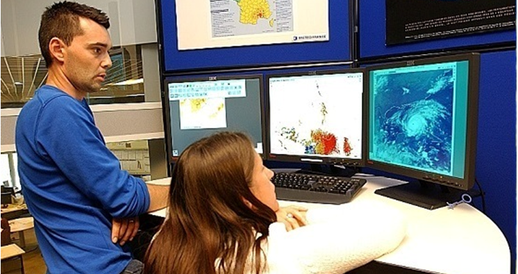
The common predictionist name commonly refers to the meteorologist responsible for developing weather forecasts. This article describes the functions of a forecaster in 2016, as well as the tools and methods he uses. All global weather services, public or private, include forecasting positions in their organizations. Part of the article is devoted to their main responsibility: the safety of people and property. But forecasters are also involved in many sectors of activity, sensitive to weather or climate, by providing decision support based on observed and forecasted conditions.
1. Forecaster, an evolving profession
The forecaster’s first function is to explain and describe, for a user or client, the future weather conditions in an area of interest. It must deliver a quality technical message with appropriate communication. This mission is an old one. It is currently present in all public National Meteorological Services (NMSs) but also in private sector entities dealing with meteorology. It is also the subject of international comparative studies in terms of staff and costs for these structures. The way in which this function is carried out has been marked by a strong evolution in recent years in line with the remarkable progress of Numerical Weather Forecasting (NWP) on the one hand (read Introduction to Weather Forecasting), and the means of observing the atmosphere on the other hand.
Without providing a historical background, the systematic use of NWP models for forecasting can be traced back to the 1970s and 1980s. It is from this period that numerical forecasting begins to provide relevant information on the possible anticipation of the occurrence of storms at mid-latitudes. Predicting these phenomena, which can cause considerable damage to people and property, is still a major concern in Europe today. Significant storms led to the creation in France of an international meteorological service [1] within the Paris Observatory in 1856 and the implementation of the meteorological vigilance system [2] in 2001.
2. Some elements of methodology
The forecasting techniques depend on the spatial and temporal scales of the “meteorological object” being forecast: a windstorm on a Pyrenean summit for the afternoon, an episode of heavy rainfall over the Cévennes for the following day, a heat wave in France for the following week. All of them are based on the approach, which includes two stages known as analysis and forecasting.
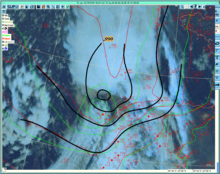
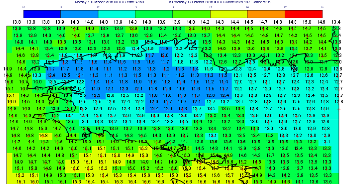
The forecasting step consists, first, in understanding how the structures identified during the analysis will evolve with the numerical simulations or, failing that, the available extrapolation products, which best represent them. In the short term, as this evolution is more or less linear, it is quite easy for the forecaster to correct defects diagnosed in the previous step: the geographical shift of an area of precipitation or fog, the underestimation of the intensity of the deepening of a depression for example. This forecast is called deterministic. In the longer term, since the evolution of the atmosphere is non-linear, some structures may disappear and others may be born. It is the strength of numerical modeling (read Weather forecasting models) to have the ability to simulate these events that an extrapolation, by definition, does not allow. The difficulty then lies in the fact that the analysis does not give the possibility to discriminate between the different options that may be present in numerical simulations.
In a second step, the approach thus becomes probabilistic. Among a range of possible developments, the forecaster looks for the most likely scenario, assesses the issues involved in forecasting and seeks to make the one that minimizes the potential forecast error. This evaluation is based on the use of ensemble forecasts (Atger, 2000) [4] (read The ensemble forecasting) but is also carried out by comparing simulations of the different deterministic models made available by the NMS. It is important to note here that the concepts of short and long term are related to the meteorological phenomena that we are trying to predict. We are talking about a predictability horizon: for a storm, it is a few hours, for a windstorm of a few days. It should also be added that the knowledge of model behaviours, acquired through the forecaster’s experience in his regular activity of analysis/forecasting and verification of his own forecasts, makes it possible to identify certain recurring defects in these NWP models. These elements are involved in the forecasting process, but are also used to improve the numerical forecast itself (reduction of identified biases). Paradoxically, this feedback makes it increasingly difficult for forecasters to critically examine models! Finally, the joint use of global models (covering the entire globe) and limited-area models (covering a limited geographical area) will be emphasized to address the problem of the different scales of atmospheric phenomena. An additional difficulty is that a limited-area simulation does not necessarily zoom in on the forecast used for its coupling, but that with some autonomy, this small-scale forecast can differ significantly from the larger-scale one.
3. Safety of people and property, an essential mission
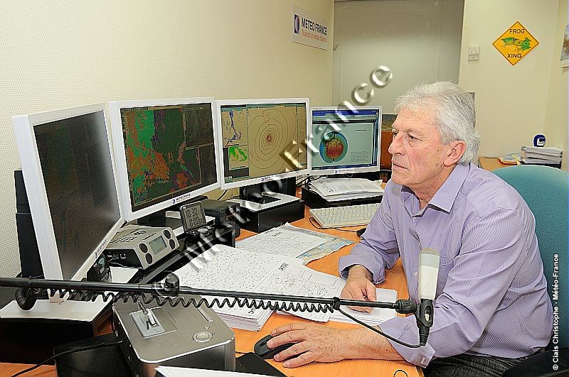
Warning authorities, citizens, transport, energy and communication infrastructure management stakeholders of the possibility of a meteorological danger is one of the main operational missions of NMSs, one of the reasons for their very existence. Since 2001 in France, this function has been carried out at Météo France through the meteorological monitoring system (Beysson, 2001) [2]. The implementation of this procedure, adopted in more or less similar terms by many countries, particularly in Europe, is the responsibility of national and regional forecasters in metropolitan France. Since it requires continuity, the organization of work is organized into permanent services that provide a 24-hour weather watch.
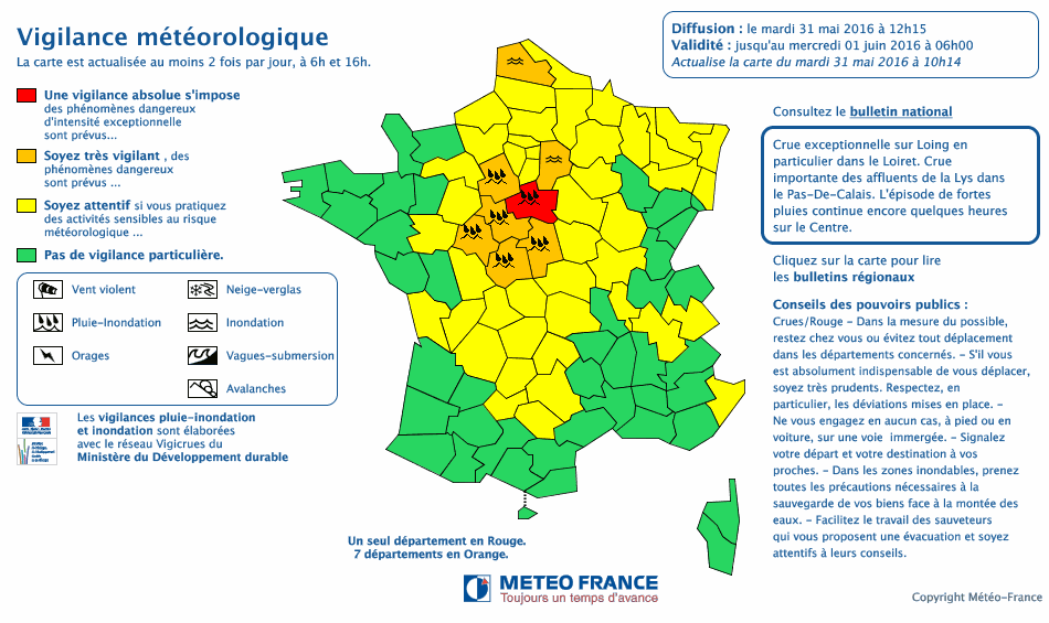
This monitoring or follow-up role, sometimes underestimated, is essential. It consists in detecting any potentially dangerous meteorological phenomenon that has not been anticipated in order to warn users who may be exposed to it as soon as possible. This task is difficult because, on the one hand, the phenomenon is by definition unexpected, and on the other hand, because the means of observation may be insufficient to detect it. For example, it is impossible to perceive the snow and ice conditions on certain road sectors in winter. In this field, the emerging technologies of connected vehicles offer interesting possibilities of use for meteorological observation. The role of anticipating dangerous phenomena is carried out by the vigilance watch map. This indicates by department the level of vigilance required in the face of meteorological and hydrological dangers for the next 24 hours, using 4 colours: green, yellow, orange, red. The choice of colour is based on criteria for exceeding the thresholds of the parameters taken into account (9 hazards in 2016).
It should be added that monitoring and anticipation roles also exist in specialized sectors. Special warning procedures apply in the maritime field for sea states. Others are being implemented in the aeronautics sector for volcanic ash suspended in the atmosphere, icing and turbulence phenomena that threaten aircraft safety. These latter procedures are carried out by forecasters with qualifications recognized by the international civil aviation organization. Finally, forecasters intervene in so-called environmental emergencies in the event of nuclear or chemical accidents or marine pollution. The use, on demand, of specific numerical models, known as dispersion models, makes it possible to provide information on the geographical areas that may be affected by pollutants.
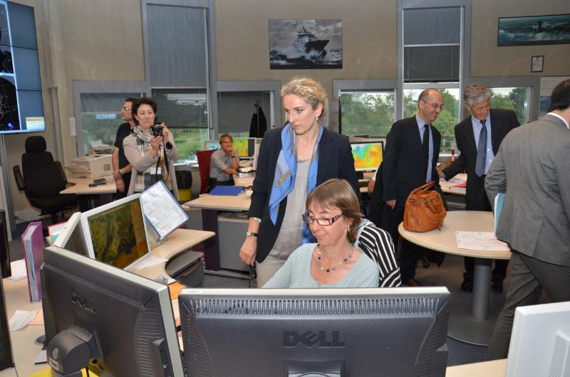
4. Meteorological assistance, examples of decision support in different fields of activity
Some sectors of activity whose achievements depend on weather conditions use the services of meteorological entities to meet their needs. This function is called meteorological assistance or advice (Figure 4). Some structures choose to integrate this function within them. This is the case, for example, in France in a company such as EDF, where teams of forecasters are involved in the management of water resources for hydroelectric production. Other structures, which have more specific needs, outsource this function. Sports event organisers are highly publicised requesters. The missions are then carried out by specially trained forecasters. They provide tailor-made services sometimes by travelling to the place of activity to be as close as possible to the user. They can use dedicated observation means, such as mobile weather radars, which make it possible to significantly improve the anticipation of the occurrence of precipitation at the event site.
5. Prospects for the future
The spectacular improvement in numerical weather prediction (NWP), the sharp increase in the spatial resolution of models (at kilometric level), the time step of data availability (intra-clockwise), the frequency of forecast refreshes (increasingly close assimilation cycles), are changing and disrupting the role of the human expert in the forecasting process. The volume of information available is now such that it is sometimes impossible to assess this process in a given time frame. An increasing proportion of forecasts are therefore automated, i.e. made available to the user directly by a computerized processing chain without human intervention. In addition, the cost reduction policies implemented in many entities in both the public and private sectors tend to limit the place of the human expert within these structures, which are therefore seeking ever greater automation. When and in what areas should the forecaster exercise his or her expertise? Should we focus only on situations with high societal or economic stakes? Should expertise invest in the new fields of application of forecasting that are currently emerging at monthly and seasonal scales? These are the questions facing weather services in the 21st century.
References and notes
[1] Roy, S., 2012: 125 years in the shadow of the Eiffel Tower, Météo France
[2] Beysson, J.P., 2001: Editorial, review La Météorologie 8ème série n°32, p. 3, by the association Météo et Climat
[3] Computer representations take many forms: maps, spatial and temporal sections, animations. They lead to performances such as augmented reality and they make it possible to know the current meteorological conditions (the present time) by studying spot observations, radiosondes, radar or satellite imagery, and shared information on social networks.
[4] Atger, F., 2000 : La prévision du temps à moyenne échéance en France, revue La Météorologie 8ème série n°32, p. 61, by the association Météo et Climat
[5] Georgiev, C., P. Santurette, K. Maynard, 2016 : Weather Analysis and Forecasting, 2nd Edition, Academic Press
[6] Beucher, F., 2010: Tropical meteorology: from trade winds to cyclones, 2 volumes, Météo France
[7] Santurette, P., A. Joly, 2002: ANASYG/PRESYG, Météo-France’s new graphical summary of the synoptic situation, Meteorol. Appl. 9, p. 129-154
[8] Giezendanner, Y., F. Guais, 2007 : Le routeur des cimes, Editions Paulsen
The Encyclopedia of the Environment by the Association des Encyclopédies de l'Environnement et de l'Énergie (www.a3e.fr), contractually linked to the University of Grenoble Alpes and Grenoble INP, and sponsored by the French Academy of Sciences.
To cite this article: GILLET-CHAULET Bruno (January 5, 2025), The role of the forecaster, Encyclopedia of the Environment, Accessed July 29, 2026 [online ISSN 2555-0950] url : https://www.encyclopedie-environnement.org/en/air-en/role-of-forecaster-2/.
The articles in the Encyclopedia of the Environment are made available under the terms of the Creative Commons BY-NC-SA license, which authorizes reproduction subject to: citing the source, not making commercial use of them, sharing identical initial conditions, reproducing at each reuse or distribution the mention of this Creative Commons BY-NC-SA license.